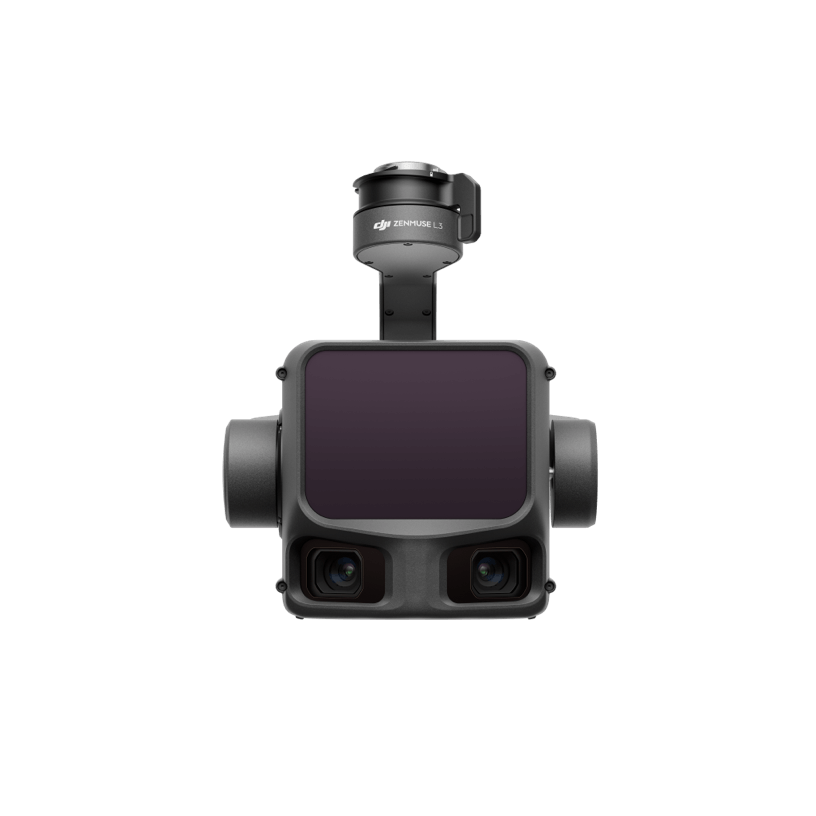
DJI’s First Long-Range, High-Accuracy Aerial LiDAR System
ZENMUSE L3
See Through, Far and True

Aerosmart UAV Trading L.L.C. is a tech company that specialises in drones and solutions in the UAE and across the GCC.
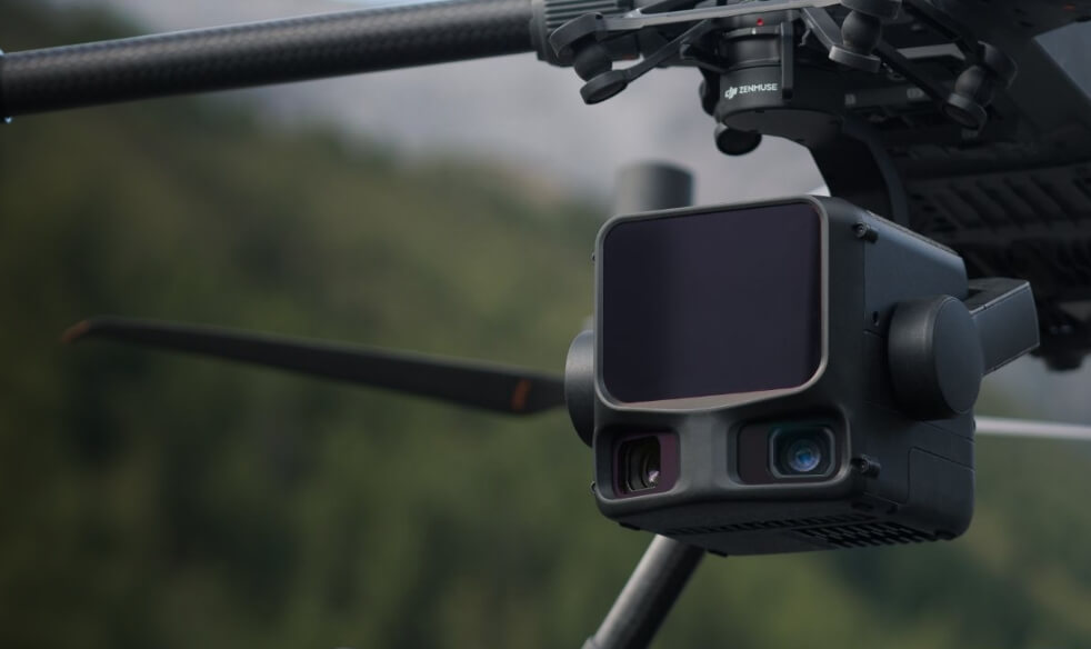
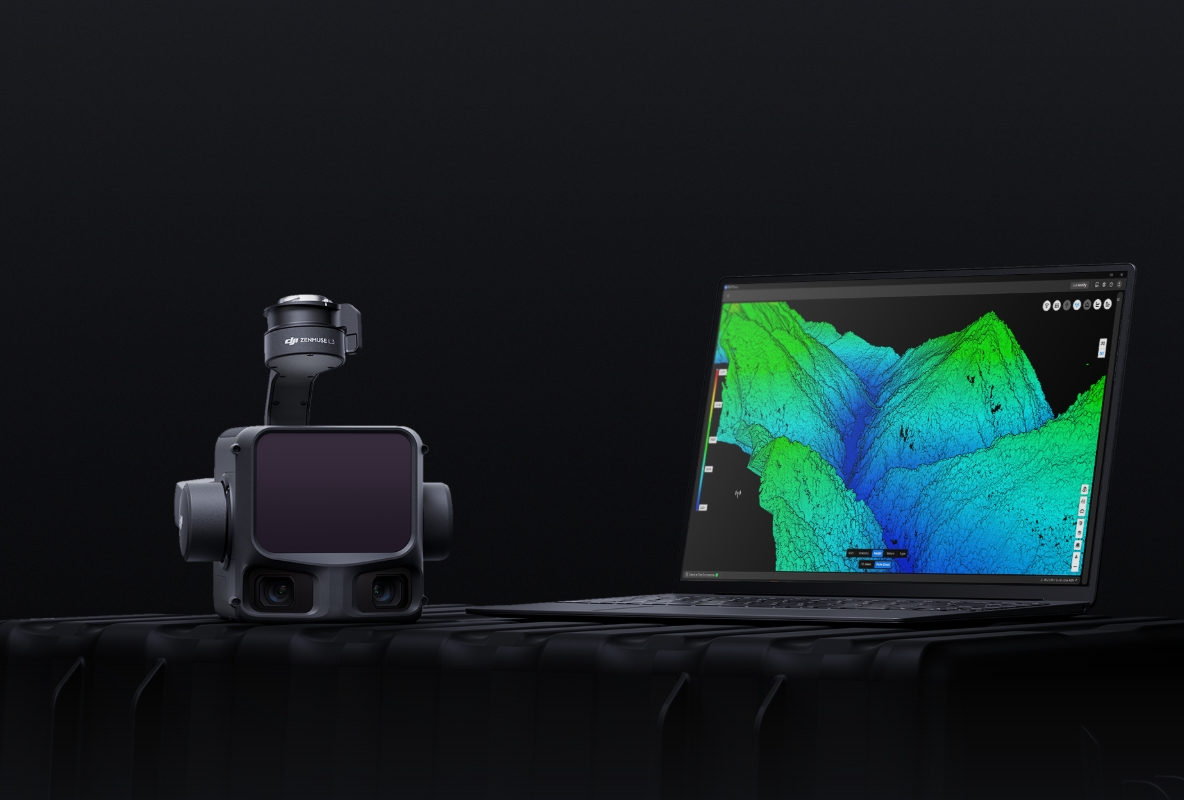

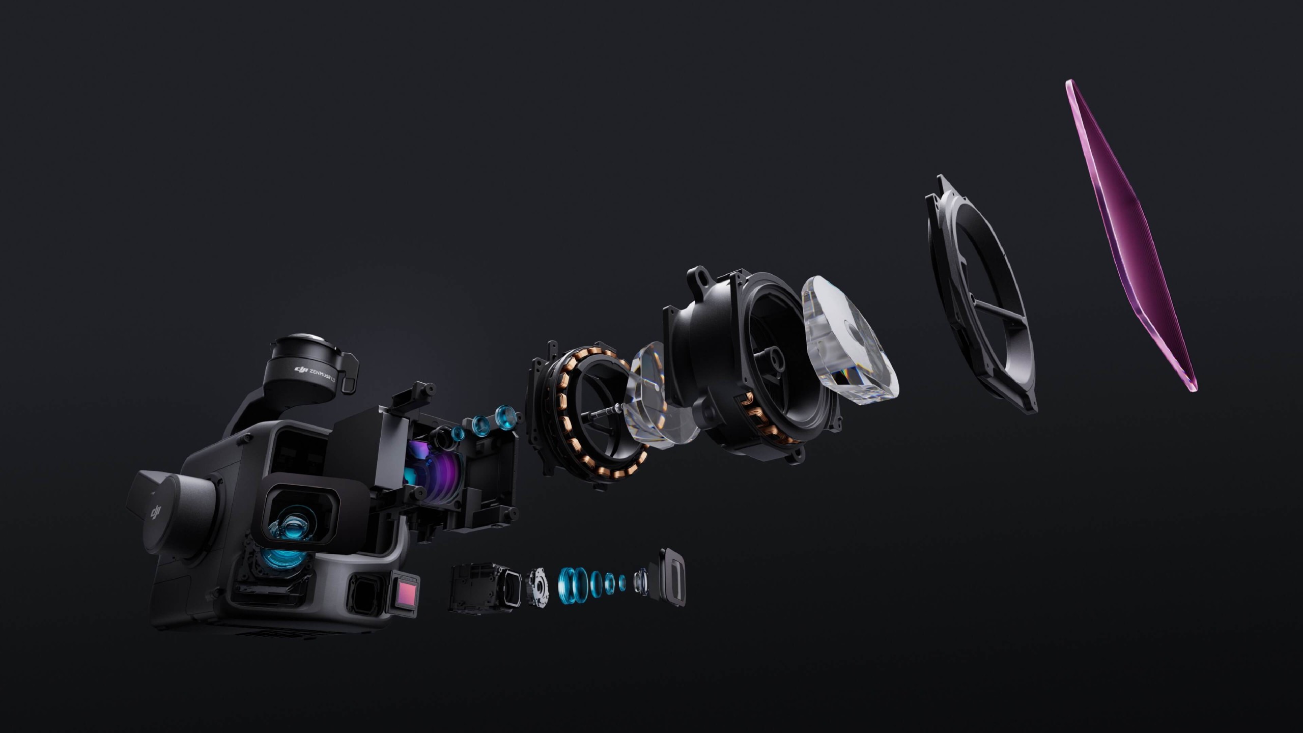
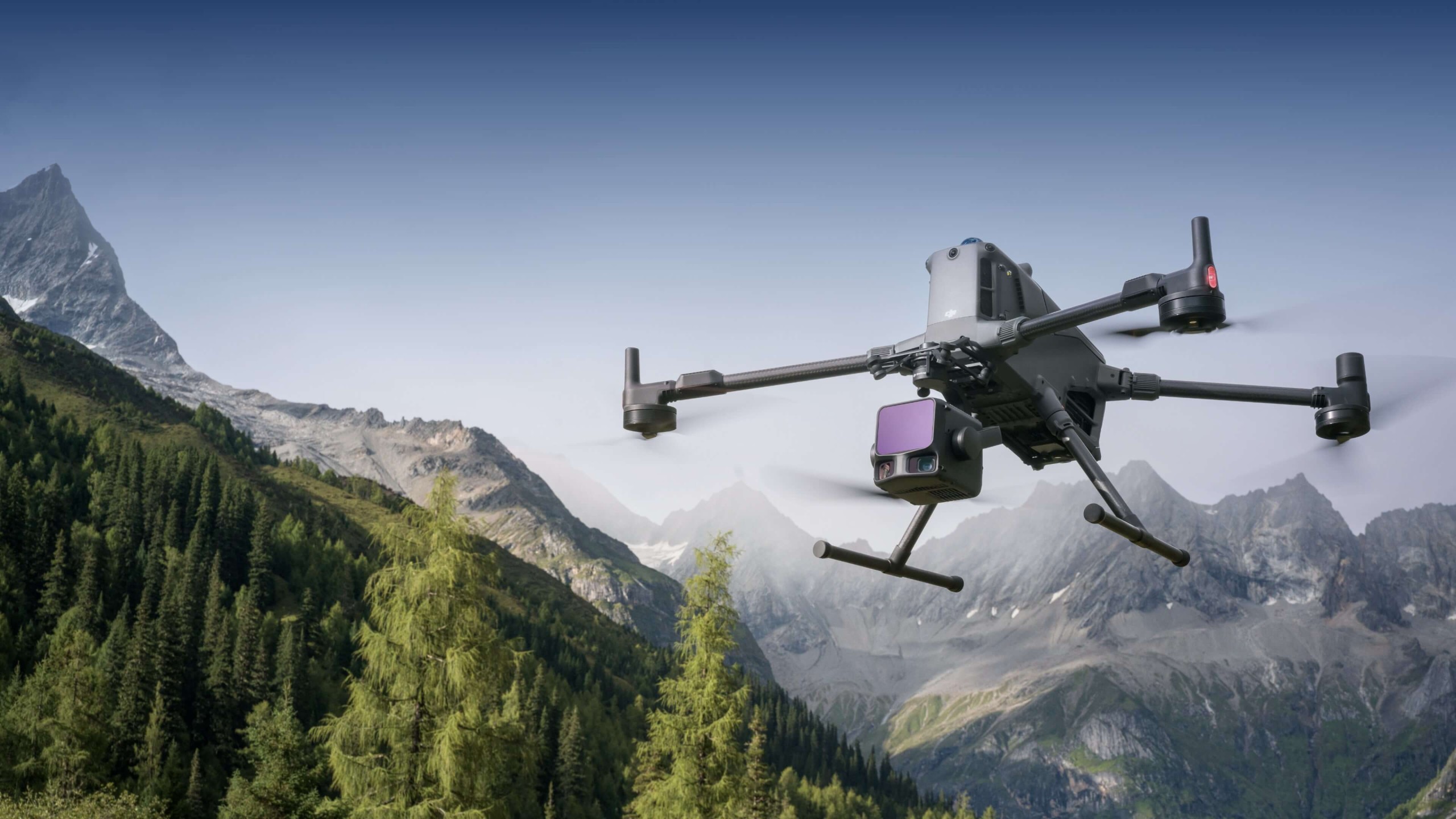
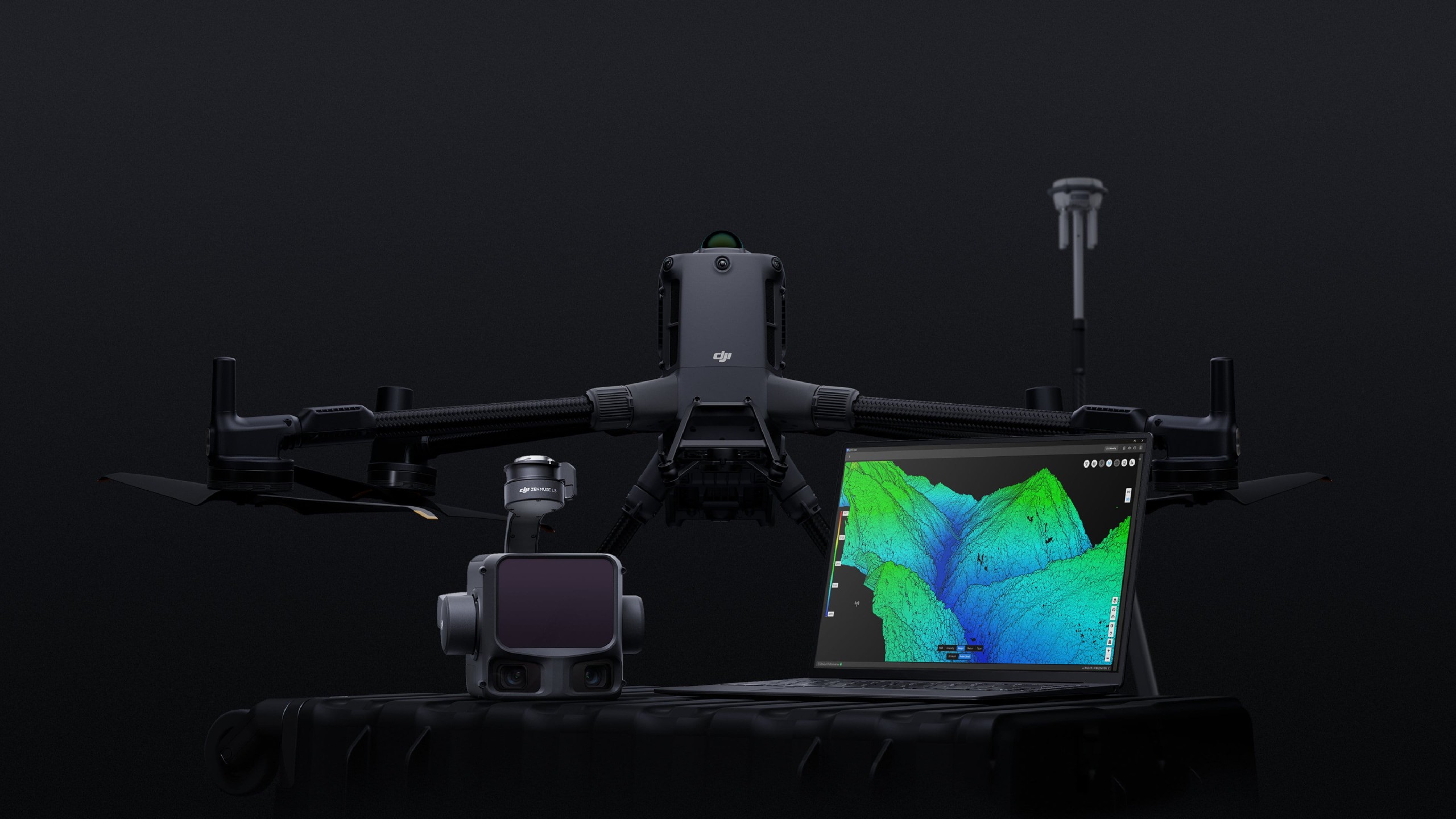
A 1535nm long-range LiDAR, dual 100MP RGB mapping cameras, a high-precision POS system, and a three-axis stabilised gimbal all integrated into a single compact unit. The DJI Zenmuse L3 delivers hardware-level geospatial performance that previous aerial LiDAR systems of comparable size couldn’t approach, establishing a new capability benchmark for airborne survey payloads.
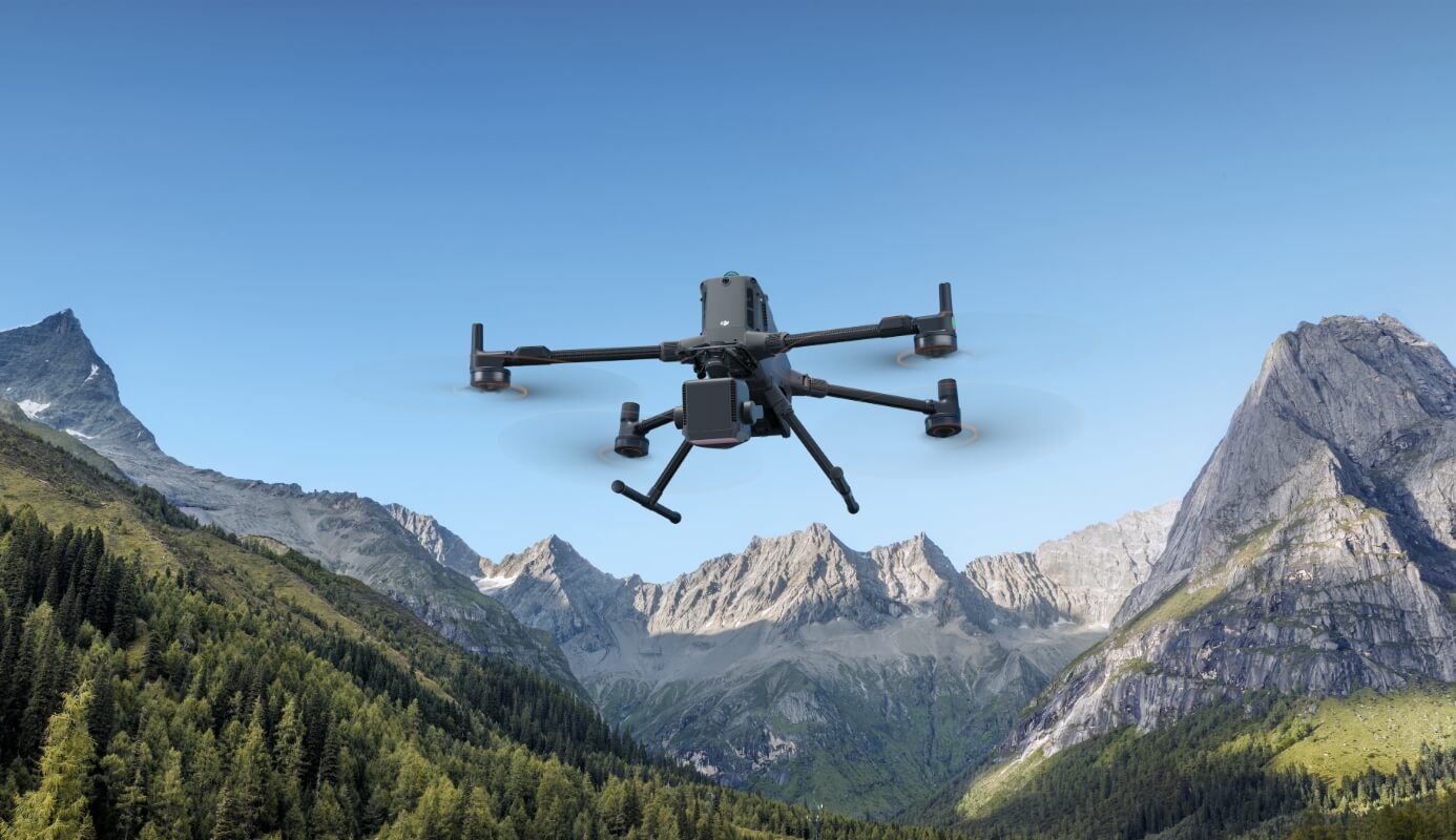
Point cloud accuracy and RGB mapping quality both improve substantially with the DJI Zenmuse L3 and efficiency scales to match. Mounted on the DJI Matrice 400, a single flight covers up to 10 km², making 100 km² of high-accuracy daily mapping output operationally achievable without compromising the precision that large-scale survey programs demand.
The high-precision POS system in the DJI Zenmuse L3 achieves 0.02° heading accuracy and 0.01° pitch accuracy after post-processing at 1σ confidence. The proprietary LiDAR delivers ranging repeatability of 5 mm at 150 m also at 1σ and operates on microsecond-level time synchronisation. Every unit goes through factory calibration before shipment, ensuring the accuracy specifications hold consistently across all delivered systems rather than varying between units.
Vertical accuracy holds below 3 cm at 120 m altitude, below 5 cm at 300 m, and below 10 cm at 500 m figures that comfortably support mapping deliverables at 1:500, 1:1000, and 1:2000 scales from appropriate operational altitudes. Point cloud thickness on the DJI Zenmuse L3 is half that of the Zenmuse L2, which improves precision in fine structural analysis and raises the quality ceiling for high-accuracy measurement applications.
The dual 100MP RGB cameras achieve a 3 cm ground sample distance at a 300 m flight altitude the resolution that makes high-accuracy photogrammetric mapping practical from elevation. Real-time position synchronisation between the DJI Zenmuse L3 and the aircraft eliminates the need for Ground Control Points while maintaining the imagery quality that survey-grade mapping outputs require.
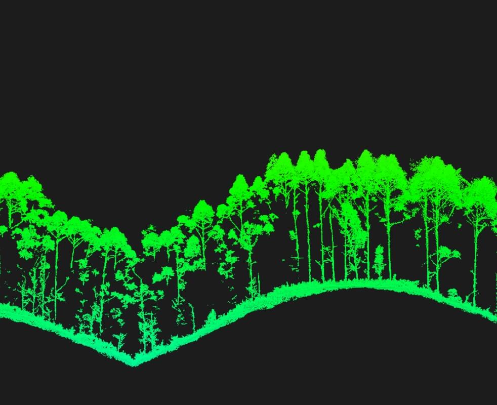
The combination of a tighter laser spot and higher single-pulse energy gives the DJI Zenmuse L3 vegetation penetration performance that wider-divergence systems at comparable pulse rates can’t match. Ground point capture under dense canopy is more complete, which translates directly into more accurate bare-earth terrain models the data quality difference that matters when the deliverable is a precise digital elevation model rather than a canopy surface.
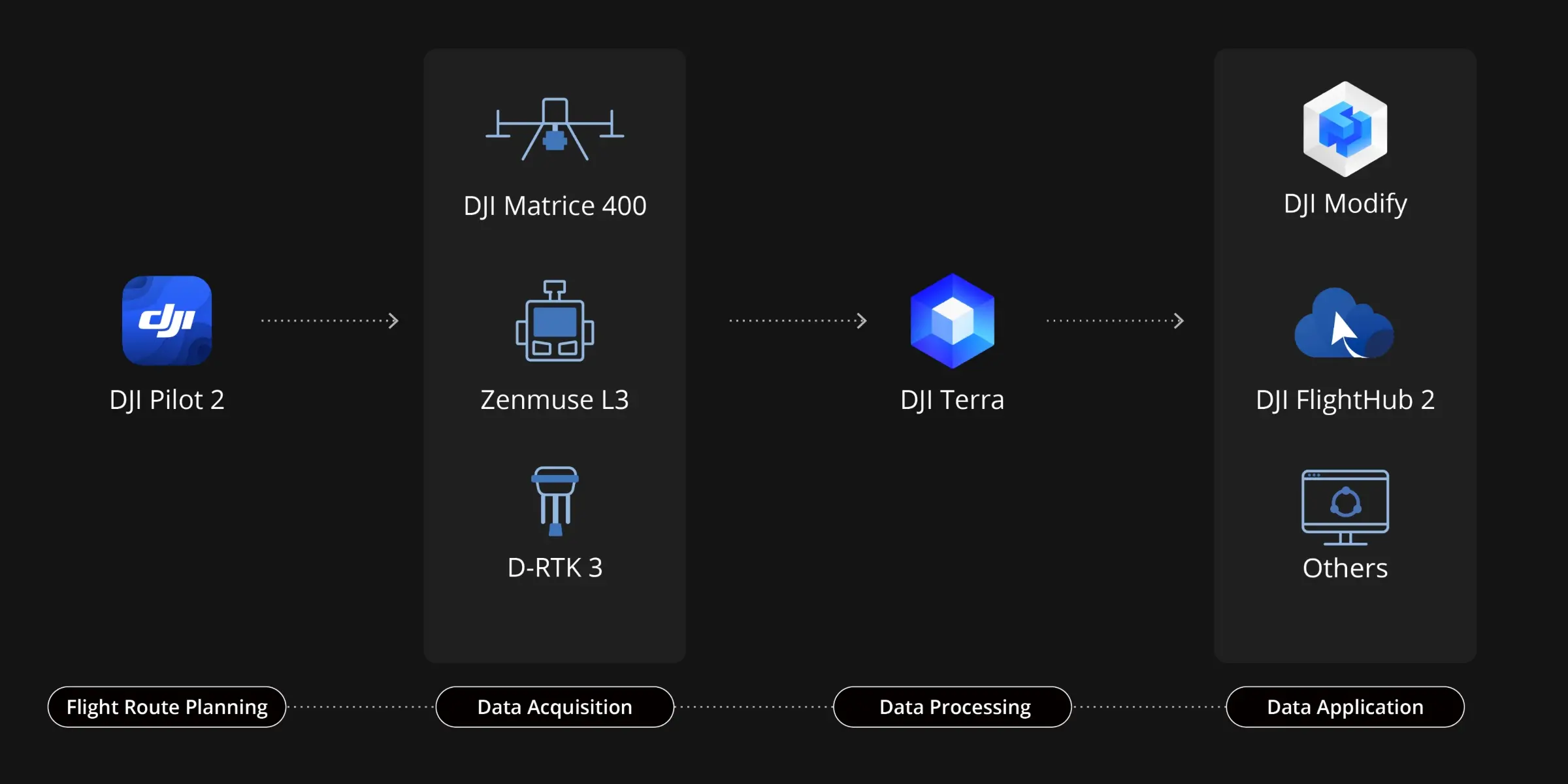
The DJI Zenmuse L3 integrates across DJI’s full ecosystem flight platform, processing software, and data application tools into a single continuous mapping workflow. From initial data capture through point cloud processing and final deliverable generation, every stage connects without requiring external tools or manual data transfers between incompatible platforms. The result is a mapping pipeline that’s both faster to execute and simpler to learn than conventional multi-platform survey approaches.
Delivers a complete workflow covering data capture, processing, and application.
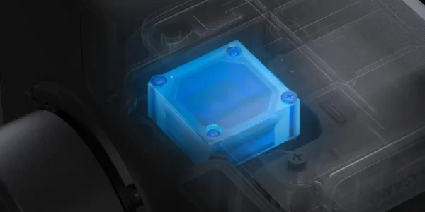
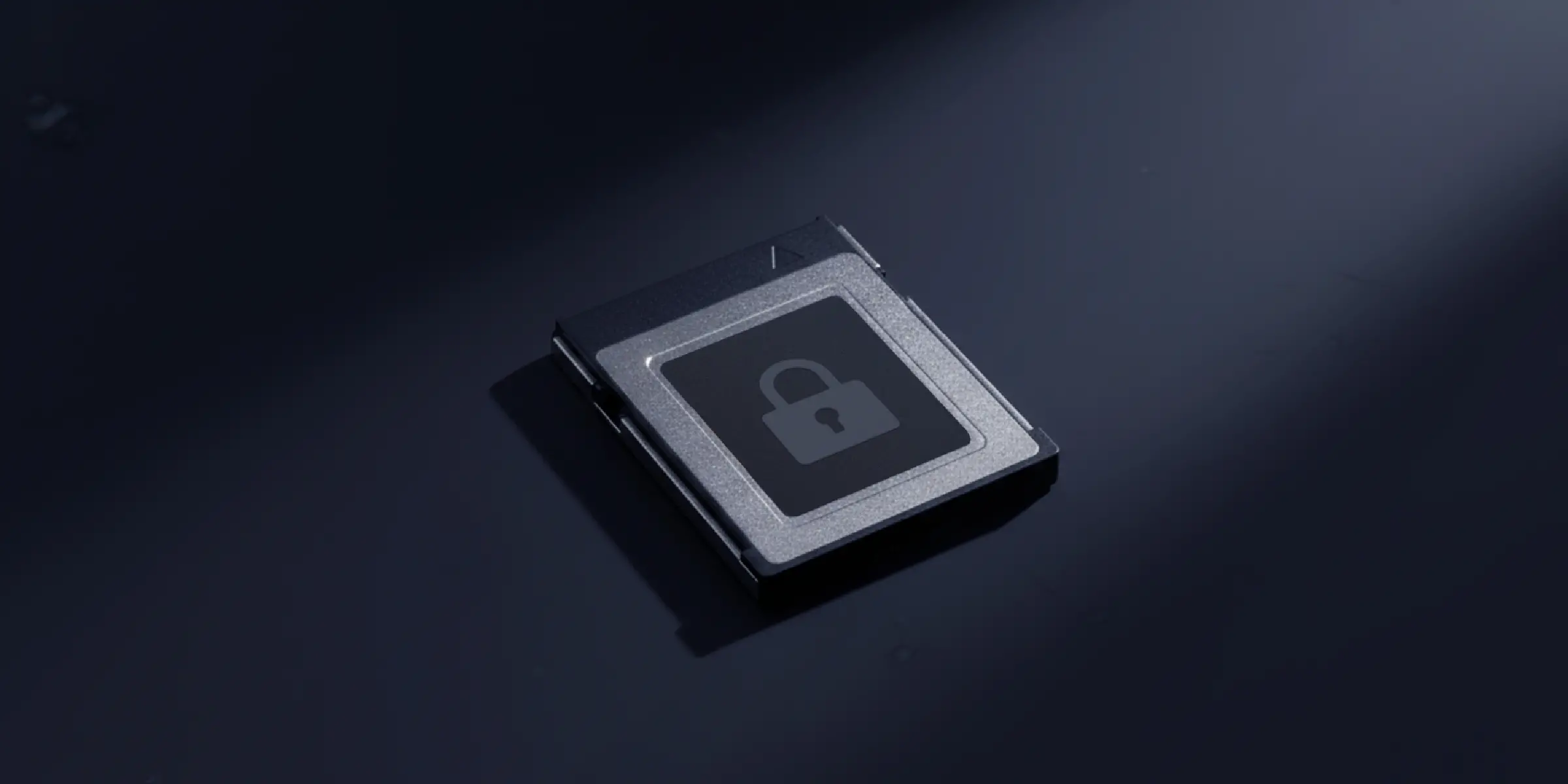
CFexpress™ memory card encryption on the DJI Zenmuse L3 protects stored survey data at the hardware level encrypted cards are unreadable without authorisation, blocking both unauthorised access and physical data theft. The DJI Matrice 400 adds one-click log clearing and AES-256 video transmission encryption, completing a layered data security architecture that covers storage, transmission, and operational log management across the entire workflow.
Comprehensive Protection | Professional Quality Assurance | Exclusive Service | Service Starts With Activation

Unlimited number of free repairs within coverage

Shared coverage for maximum protection

Hassle-free repair with free shipping both ways

Swift response from DJI technical experts
An additional 1-year extended warranty will be provided for your product after the standard warranty period ends.
Support provided by a professional engineering team
Original parts, quality assurance
 Topographic Survey
 Earthwork
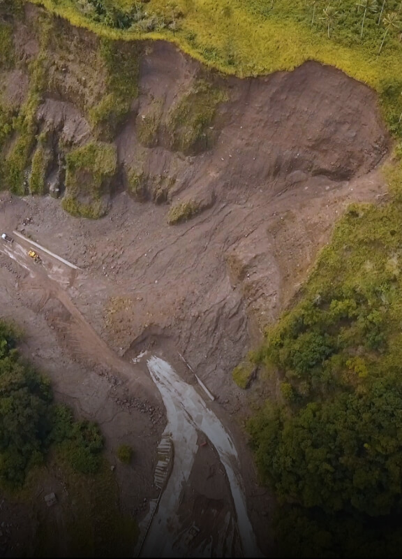 Geological Disaster Investigation
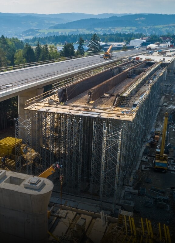 Engineering Survey
 Forestry Management
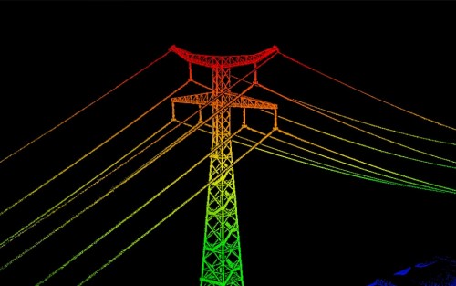
 Electricity
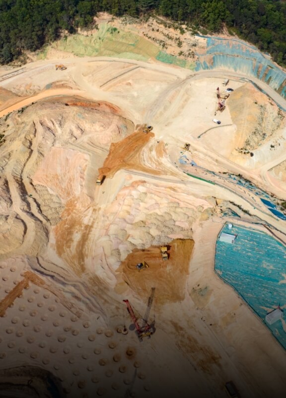
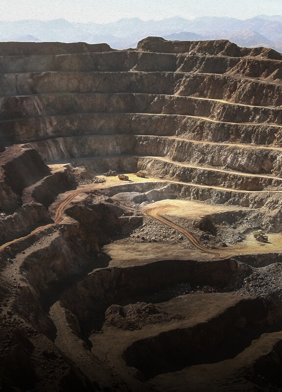 Mining Survey
 Emergency Survey
Your journey into the extraordinary begins here. Share your details for a personalized Zenmuse L3 quote and let your imagination soar.
✅ Thank you for reaching out. Your message has been successfully sent, and our team will get in touch with you shortly.