
Aerosmart UAV Trading L.L.C. is a tech company that specialises in drones and solutions in the UAE and across the GCC.
Aerosmart UAV Trading L.L.C. is a tech company that specialises in drones and solutions in the UAE and across the GCC.


DJI Modify licensing is available in the UAE through Aerosmart, Dubai, with pricing depending on the license tier and term selected. Request a same-day quote in AED with regional invoicing.
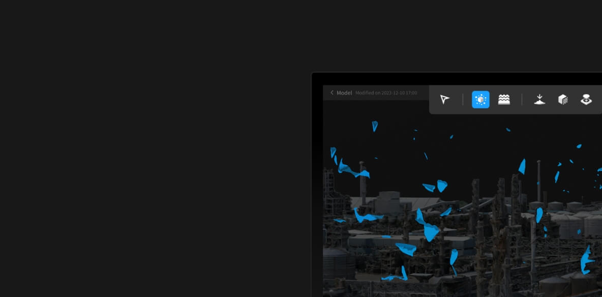
Cleaning reconstructed 3D models repairing textures, flattening water surfaces, removing vehicles and floating artefacts — so deliverables look professional without hours of manual mesh editing.
Yes it is designed as the editing stage after Terra reconstruction, opening Terra outputs directly and exporting standard formats for GIS and CAD use.
Survey firms, construction contractors and government mapping teams that publish 3D models to clients and need them presentation-ready.
Yes Aerosmart provides activation help, workflow guidance and ongoing regional support for every DJI Modify license supplied in the UAE.
Your journey into the extraordinary begins here. Share your details for a personalized DJI Modify quote and let your imagination soar.
✅ Thank you for reaching out. Your message has been successfully sent, and our team will get in touch with you shortly.