Aerosmart UAV Trading L.L.C. is a tech company that specialises in drones and solutions in the UAE and across the GCC.
Aerosmart UAV Trading L.L.C. is a tech company that specialises in drones and solutions in the UAE and across the GCC.

The growing focus on drone mapping has made the use of the latest drone technology obvious. This is how it has become the basis of the transformative force that helps reshape the industries of today and tomorrow. The advancement in drone technology shows how the projects in real estate, construction, infrastructure, and other industries are planned and handle.
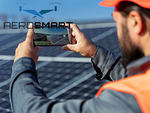
If you get professional assistance from a drone survey company in UAE, it can help businesses know how to adopt the latest technology. It is mainly because it helps the companies to unlock the highest potential level and stay ahead of the competition, to sustain in the UAE market. If you know this, you can also find the rising use of drone mapping and how it is becoming the core of industrial work in the UAE.
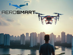
Rising Use of Drones in the UAE Market
As the UAE has become a hub for future industrial developments, drone technology plays a vital role in handling the mega construction, sustainable projects and the like. This is mainly due to the growing demand for aerial technology that helps capture high-end images and convert them to precise models or maps that can further help the decision makers in the business.
When compared with the traditional methods, drone mapping can deliver better and precise outcomes, which is also cost-effective. It helps create data-rich reports that help a business be in line with its standard of innovation, precision and speed in the UAE marketplace.
Now, the question may arise how 2025 will become a turning year for the growing dependency on drone technology.
How is 2025 Witnessing a Sudden Rise in Use of Drone Technology?
The sudden rise in the use of drone technology in 2025 is due to the current trends:
Booming of the Construction Site
Drone surveys are common for developers to meet deadlines in their construction projects. It ensures the efficiency and safety of the project, no matter how large or small-scale the project might be. The drone surveys can get an aerial view quickly, often reaching places which are otherwise challenging to access.
Sustainable Initiative
UAE’s business visions are based on sustainable initiatives, and that’s where effective drone monitoring is encouraged by businesses. It helps with agricultural practices and environmental protection. That’s where the survey works to help achieve an accurate and precise outcome.
Focus on Smart City
Projects on smart city expansion are coming up on a large scale, and they need real-time mapping. It is mainly to know the quality and look for any potential issues of the smart city projects. Use the latest drones to find the best data reports that enhance the level of a construction project to the next level.
That’s how the influence of drone technology is a significant change, and it is the inclusion of the essential tools across projects in industries in the UAE.
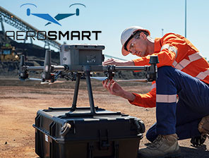
How can a Drone Survey Company be Helpful in the UAE?
The transformation and shift of focus to drone technology increases the reliance on the drone survey company in the UAE. Businesses are investing in more than just drones, as they can professionally interpret data, ensure compliance and deliver effective insights regarding a project. It is the company that can offer high specialised services to help handle a project effectively. Some of the components that can make a significant difference are:
This is how it is better to partner with a reliable service provider who can stay ahead of others and ensure compliance as per the highest UAE regulations. If a business needs to sustain in the Dubai market, it has to adhere to the use of modern drones, which makes the task a lot easier and convenient to achieve the desired results.
Let us take a look at the industries the drone mapping service can help with in the UAE.
Real Estate
The 3D models in drone mapping are common and can redefine visualisation. It helps both buyers and investors with an enhanced experience during the construction process.
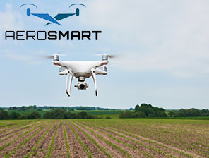
Agriculture and Food
Drone mapping can help in agriculture to achieve a precise picture, monitor soil health and help understand the condition of the irrigational land. The increasing influence of drones also ensures reliable on sustainable food and its security.
Infrastructure and Construction
Drone mapping has become a standard for handling construction projects in 2025. Drones are known to track the project, monitor every detail and ensure the safe sites and what the survey costs can be.
Energy Utilities
Oil and gas industries mostly use drones to capture images, inspect and monitor large-scale areas efficiently. Using drones can give a precise image that further helps in creating a detailed analysis.
Environmental Project
It includes checking the protection of the coastal area, checking desert monitoring with the latest drone models. This is a sustainable choice between preserving the environmental assets and urbanisation.
Therefore, try to make the most of the latest drone technology in various industrial work. It does, more than just drone mapping and offers superior results to the conventional methods used.
As the UAE’s business land embraces the use of the latest technological innovation, it is modern drone mapping is gaining popularity in the UAE. The technologies that are shaping the future are:
This is how there is increasing reliance on modern technology, and drone mapping services will continue to be in demand for the UAE industries. That’s a way the future of businesses in the UEA marketplace will thrive.