Aerosmart UAV Trading L.L.C. is a tech company that specialises in drones and solutions in the UAE and across the GCC.
Aerosmart UAV Trading L.L.C. is a tech company that specialises in drones and solutions in the UAE and across the GCC.
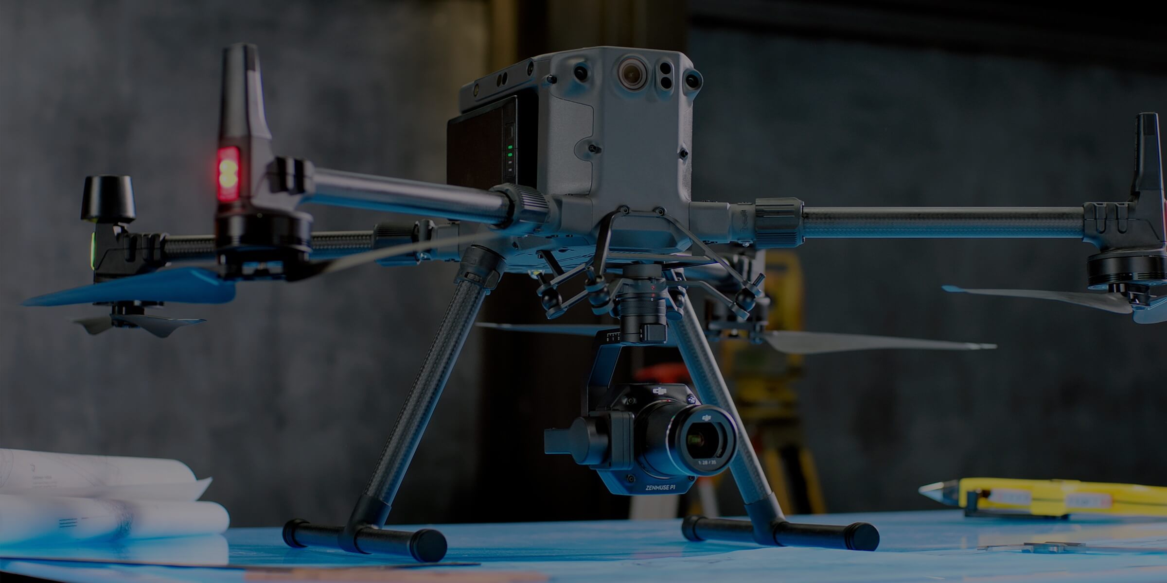
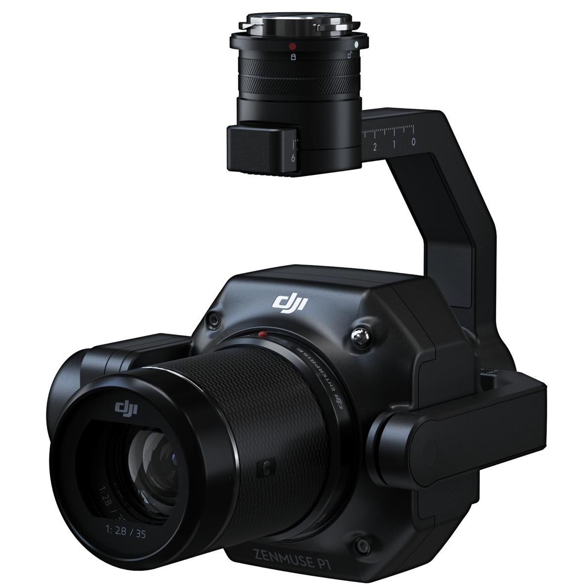
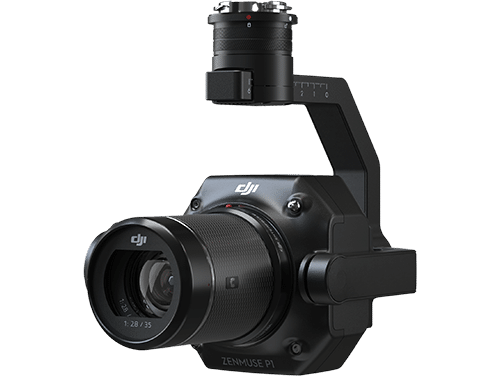
A full-frame sensor, interchangeable fixed-focus lenses, and a 3-axis stabilised gimbal built specifically for photogrammetry missions the DJI Zenmuse P1 raises both the efficiency ceiling and the accuracy standard for professional aerial survey payloads across every scale of operation.

Accuracy without GCPs
3 cm horizontally / 5 cm vertically

High Efficiency
3 km² covered in a single flight

45 MP Full-frame Sensor

3-axis Stabilized Gimbal
Smart Oblique Capture

Global Mechanical Shutter
Shutter Speed 1/2000 Seconds

TimeSync 2.0 – synchronization
at the microsecond level
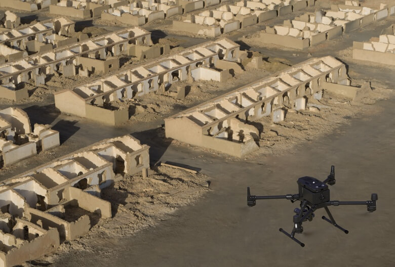
A low-noise, high-sensitivity full-frame sensor running a 0.7-second capture interval keeps data collection continuous throughout the flight without gaps in coverage covering 3 km² per mission from a single battery.
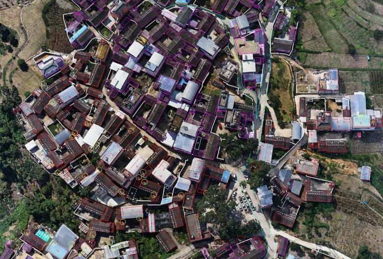
The global mechanical shutter removes motion blur from every frame, and TimeSync 2.0 synchronises the camera, controller, RTK module, and gimbal at the microsecond level. The result is centimetre-accurate georeferenced data with real-time position and orientation compensation applied across every image in the dataset.
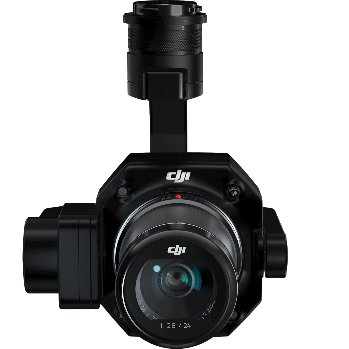
Three interchangeable focal lengths 24mm, 35mm, and 50mm adapt the DJI Zenmuse P1 to 2D orthomosaic, 3D oblique, and detailed surface modelling missions from the same hardware platform using Smart Oblique Capture.
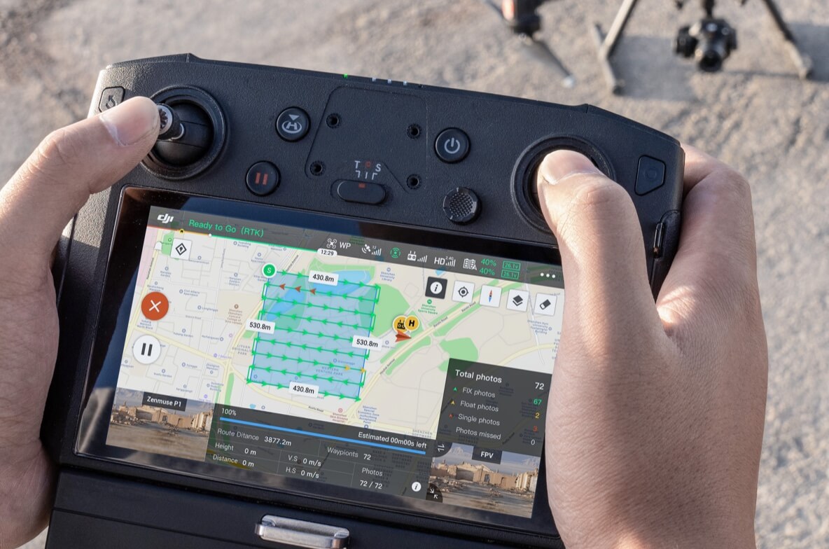
A single workday with the DJI Zenmuse P1 covers 7.5 km² of oblique survey area. Smart Oblique Capture drives the gimbal through each required angle automatically without pilot input, collecting exactly the frames the reconstruction needs. At flight area boundaries where oblique datasets typically accumulate redundant frames, the system captures only the images essential to the model reducing post-processing workload by 20% to 50%.
Your mission data management – streamlined.
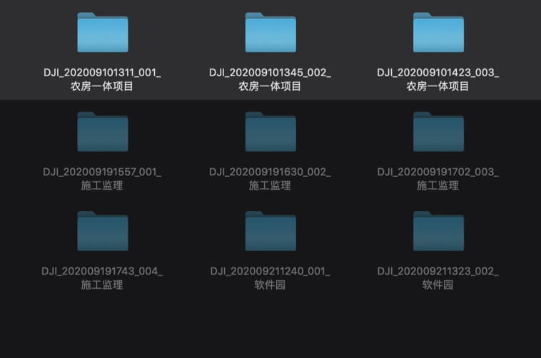
Each completed mission’s output files automatically tag to the corresponding Mission Name and Mission Time, keeping data organised without manual file management.
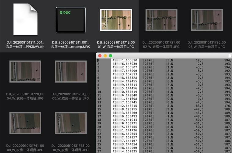
Photos, GNSS positioning data, and TimeStamps.MRK files store together in a single centralised location every data type from each mission consolidated without fragmented folder structures.
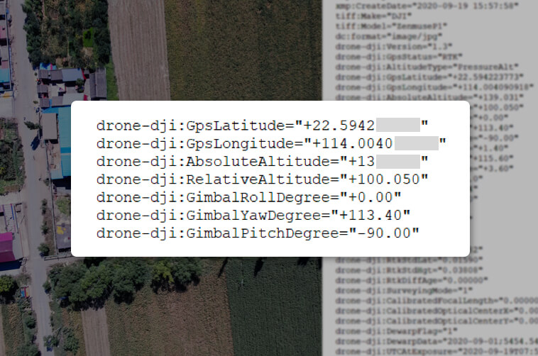
Complete camera calibration parameters intrinsic and extrinsic embed in each image’s metadata alongside RTK positioning status, giving processing software everything it needs without a separate calibration file.
Post-flight data quality verification runs immediately on site the Fieldwork Report shows total images captured, position data for each frame, RTK status throughout the flight, and achieved positioning accuracy. Any gaps or anomalies surface before the team leaves the survey location.


The DJI Zenmuse P1 is available in the UAE from Aerosmart, Dubai. Pricing depends on the configuration and accessories selected request a same-day quote in AED, with official warranty included.
3 cm horizontal and 5 cm vertical without ground control points, using RTK on the aircraft cutting days of GCP fieldwork from survey projects.
P1 for high-detail orthomosaics and textured 3D models of open sites; L2 where vegetation cover or fast point-cloud delivery matters. Many UAE survey teams run both. Aerosmart advises per project type.
DJI Matrice 300 RTK and Matrice 350 RTK. Pair with DJI Terra or PIX4D software for processing all available from Aerosmart in Dubai.
Yes every DJI Zenmuse P1 sold by Aerosmart is a genuine unit covered by the official warranty, with local repair and after-sales support handled in Dubai.
Your journey into the extraordinary begins here. Share your details for a personalized DJI Zenmuse P1 quote and let your imagination soar.
✅ Thank you for reaching out. Your message has been successfully sent, and our team will get in touch with you shortly.