Aerosmart UAV Trading L.L.C. is a tech company that specialises in drones and solutions in the UAE and across the GCC.
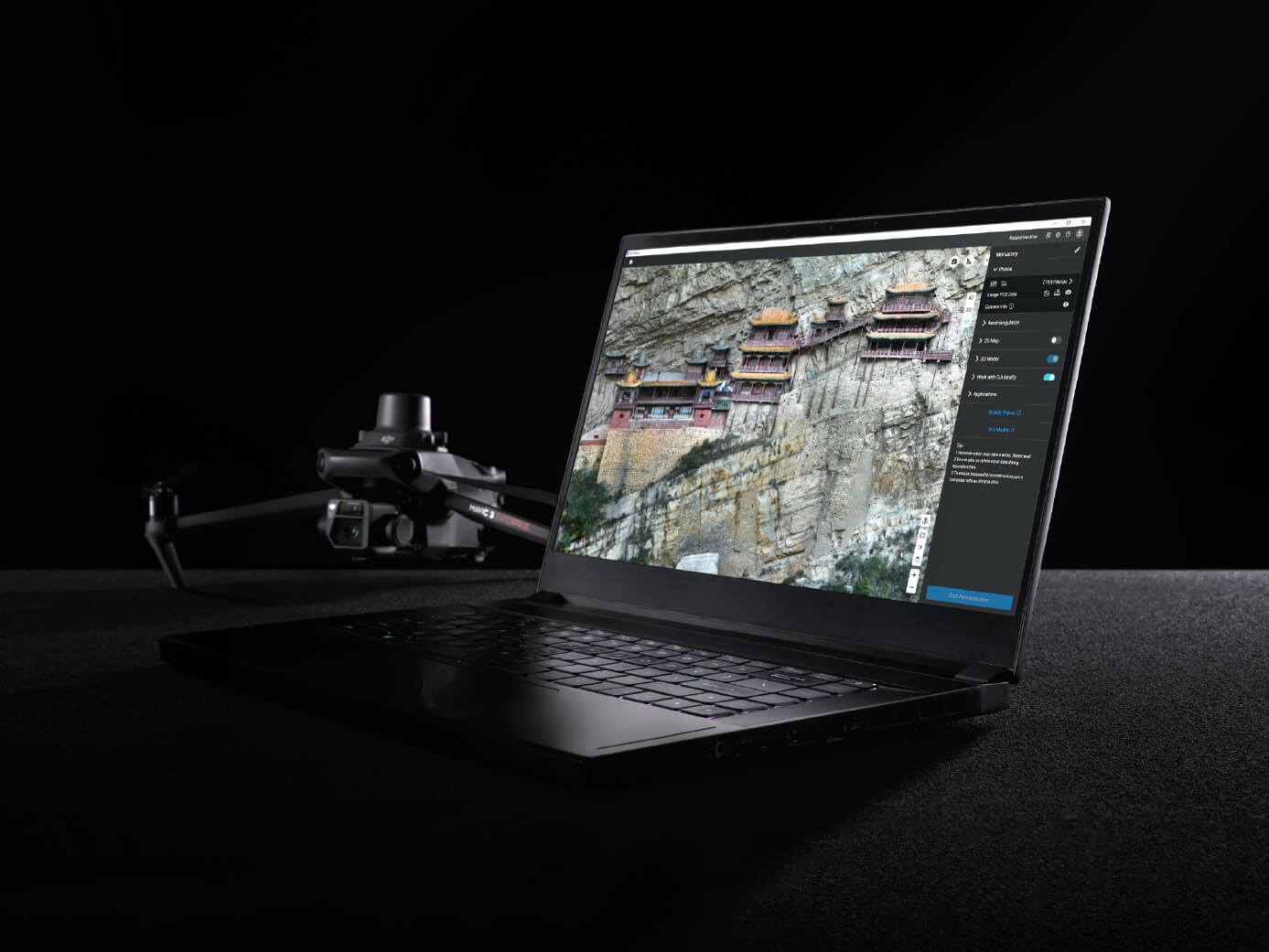
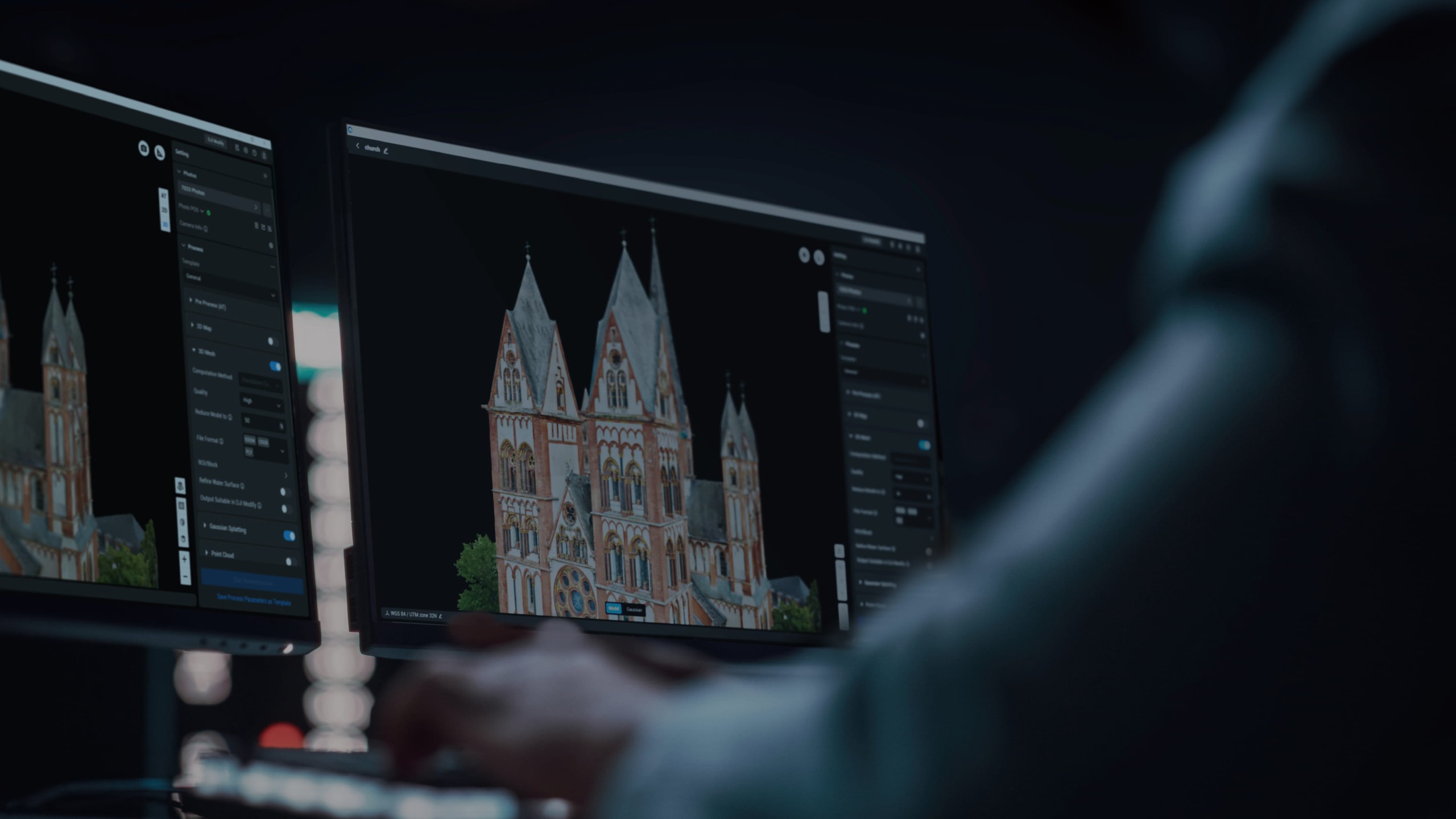
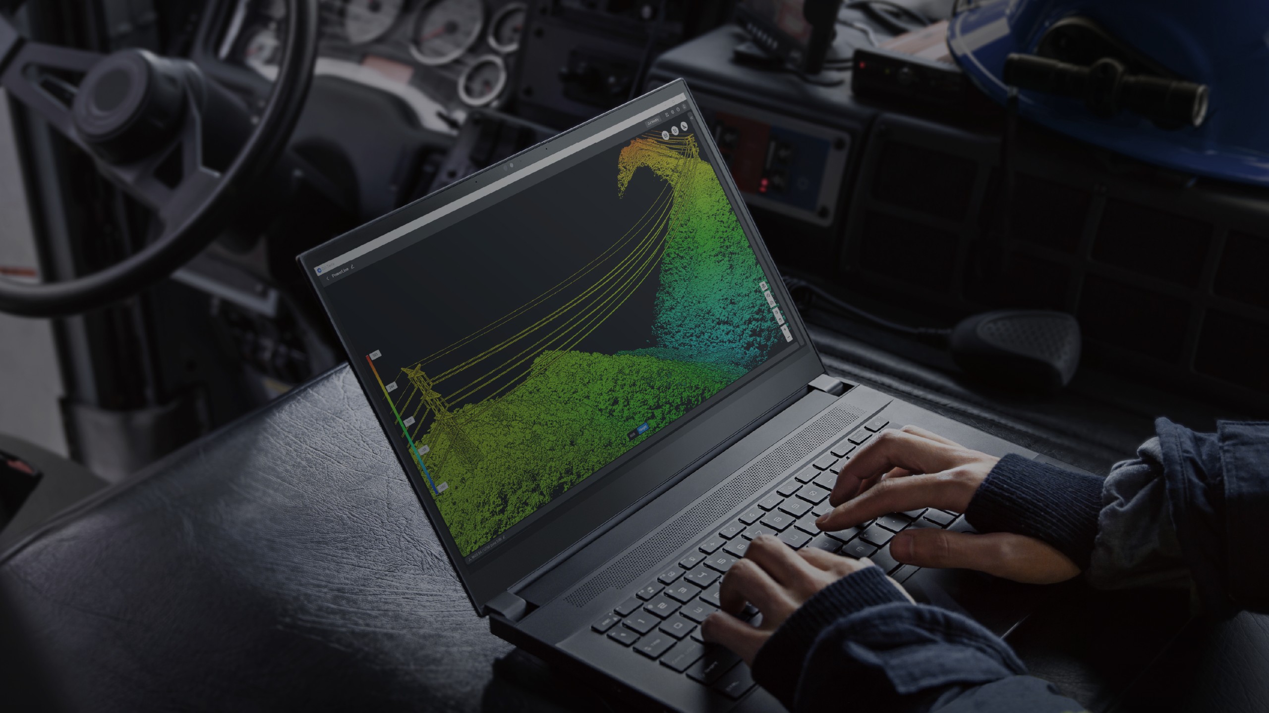
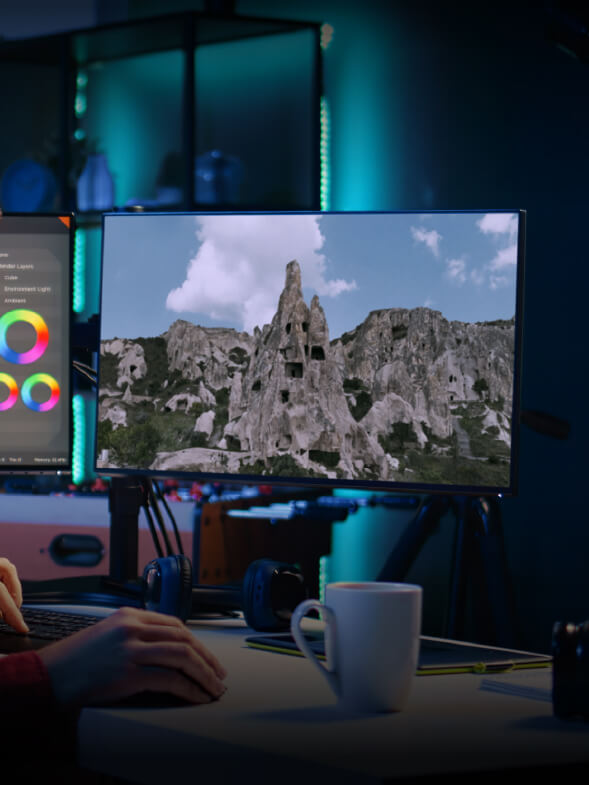
Terra introduces Gaussian Splatting, which quickly generates detailed and realistic 3D models from photos, accurately restoring diverse scenes such as cultural relics, architectural projects, urban blocks, and scenic gardens. Compared to visible-light oblique photogrammetry technology, 3D Gaussian Splatting significantly enhances the representation of complex elements like fine structures, transparent and reflective objects, and vegetation. In addition to producing more natural rendering effects, this technology can also generate distortion-free orthomosaics, further improving the quality of the results.
Terra processes approximately 500 photos per hour [2], allowing a single-block modeling process [3] to be completed in just 30-40 minutes [2]. In large scenes with over 10,000 photos, the reconstruction speed is twice that of Terra Mesh [1], leading the industry. The strong processing capability helps users obtain high-quality 3D data more quickly, significantly shortening project timelines and enabling rapid modeling and application in large-scale scenes.
With efficient resource utilization, Terra supports city-scale scene reconstruction using Gaussian Splatting. Approximately 300-400 photos can be processed per 1 GB of available RAM [4], and a single processing task can handle up to 30,000 photos [4]. This capability fully meets the 3D modeling needs of large-scale, complex environments such as urban spaces, industrial parks, and infrastructure, providing a solid data foundation for urban digitalization and smart city management.
Terra prioritizes user experience by offering a streamlined, intuitive workflow with low hardware requirements. It requires only 4 GB of GPU memory and 32 GB of RAM for smooth operation, eliminating the need to purchase high-performance computers. This greatly lowers the technical threshold for Gaussian Splatting, making advanced 3D reconstruction truly accessible to a broader range of industries.
Terra supports one-click export to mainstream 3D Gaussian Splatting data formats such as PLY and B3DM (3D Tiles). The results can be seamlessly integrated into third-party platforms across industries, including surveying and mapping, gaming, and film production. Standardized data outputs facilitate efficient data reuse and sharing across multiple fields and platforms, allowing users to expand flexibly into diverse application scenarios.
Terra rapidly generates high-precision 3D models, point clouds, true digital orthophoto maps (TDOM), and digital surface models (DSM) from photos. Users can adjust the number of meshes in 3D models and the resolution of 2D maps. The software also supports export to various industry-standard formats for seamless integration and downstream applications.
Terra achieves centimeter-level mapping accuracy without the need for ground control points by deeply integrating data collected by DJI mapping drones (equipped with RTK modules) with intelligent algorithms. It supports the output of various results, including 3D mesh models, point clouds, and 2D maps. For DJI Enterprise mapping drones like Matrice 4E, Terra offers dedicated accuracy enhancements. Even in complex environments, Terra consistently meets 1:500 mapping standards, supporting the demanding requirements of engineering surveys, topographic mapping, and more.
Speed is central to Terra’s design. With exceptional reconstruction capabilities, it processes data quickly and efficiently. For smaller projects, results can even be generated on-site in real time. Terra supports large-scale 3D reconstruction, processing up to 30,000 photos on a standalone workstation within three days [6], or delivering results in just 21 hours using cluster reconstruction [7]. For 2D reconstruction, a standalone workstation can process 5000 photos in under two hours [6], while cluster reconstruction reduces the processing time to 80 minutes [7]. This high level of efficiency ensures projects are completed on schedule and to rigorous quality standards, enabling industry users to meet the demands of urgent and high-intensity tasks with confidence and reliability.
Terra enables deep integration of LiDAR and visible light data. With a single Zenmuse LiDAR acquisition, users can simultaneously generate high-precision point clouds, 2D maps, and 3D mesh models. This data fusion approach significantly enhances model completeness and detail, especially in environments with complex structures such as bridges and substations. It meets the needs of industries including power energy, transportation, and infrastructure.
Leveraging advanced positioning technologies such as RTK and PPK, Terra processes point cloud data from the Zenmuse LiDAR to achieve survey-grade, centimeter-level accuracy without the need for ground control points. This ensures reliable data support for high-standard mapping and engineering monitoring applications.
Terra automatically generates waypoints and flight routes based on one or more points selected in a local 3D reality model or point cloud, or a third-party point cloud. A simulated camera view that includes the selected point is displayed on the screen, enabling more precise waypoint selection and efficient flight route planning to automate inspection workflows. In addition to previously supported drone models [8], Terra now also supports Matrice 4T and Matrice 4TD, addressing the detailed inspection needs of a broader range of industries.
Terra efficiently processes large-scale LiDAR point cloud data, handling approximately 1 GB of point cloud data per 1 GB of available RAM. This enables seamless management of extensive projects. A computer with 32 GB of RAM can process up to 120 GB of data [5], covering an area of approximately 10 square kilometers [9]. For city-scale data processing, workstations with 128 GB of RAM is supported [5][10]. [11]
Leverage multispectral data from DJI Mavic 3 Multispectral and Phantom 4 Multispectral to generate vegetation index maps, including NDVI and NDRE, for actionable insights into plant growth and health. Terra also supports radiometric correction and the creation of reflectance maps for remote sensing research.
Terra enables the creation of accurate prescription maps using multispectral or visible light data. Simply select your crop type (Field or Fruit Tree) to quickly generate 2D maps and optimized route plans for DJI Agras drones. Terra also supports the generation of variable-rate spraying prescription maps, helping improve crop yields while reducing operational costs.
DJI Terra features robust built-in PPK (Post-Processed Kinematic) capabilities, ensuring high-precision aerial survey results in any environment. The platform supports local PPK for visible light imagery, local PPK and cloud-based PPK [14] for LiDAR. This guarantees centimeter-level positioning accuracy even in areas with limited network connectivity or where RTK is unavailable.
Your journey into the extraordinary begins here. Share your details for a personalized DJI Terra quote and let your imagination soar.
✅ Thank you for reaching out. Your message has been successfully sent, and our team will get in touch with you shortly.