Device Binding and Free Quotas [3]
Device Binding and Free Quotas: Upon initially binding devices to an organization, corresponding livestream minutes, mapping image quotas, and storage space will be granted.
FAQ
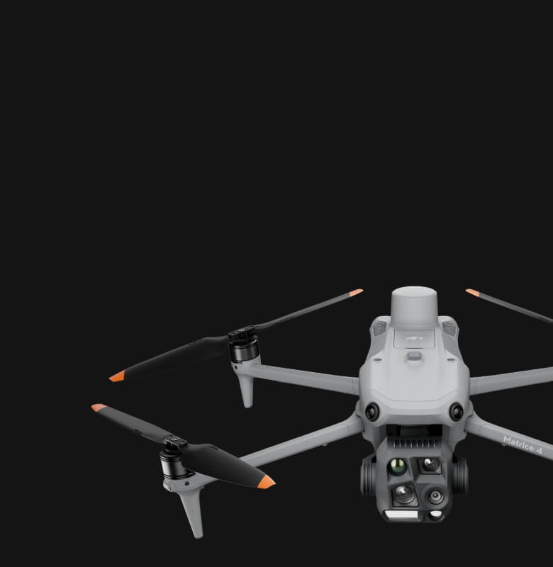
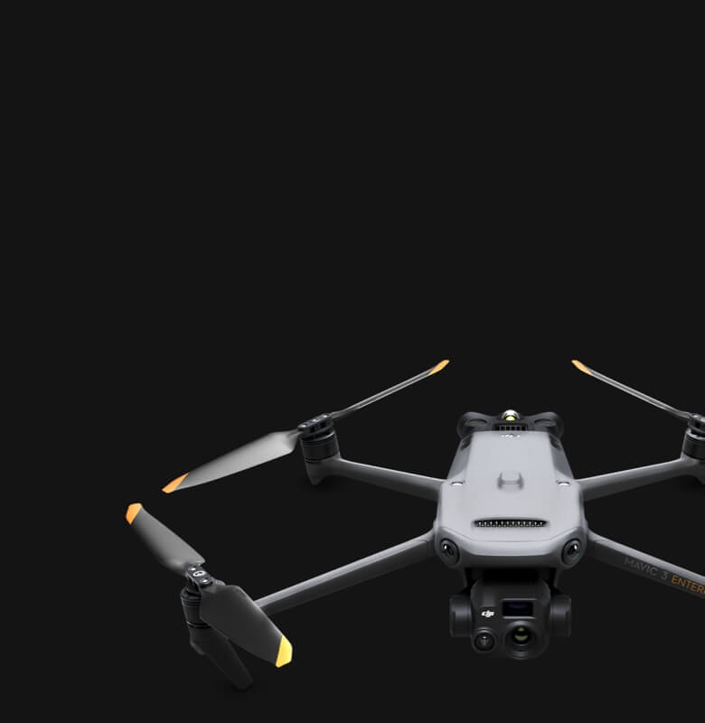
Aerosmart UAV Trading L.L.C. is a tech company that specialises in drones and solutions in the UAE and across the GCC.
Effortlessly control the drone remotely via a mouse and keyboard. Quick operations like Mouselook mode and drag-select zoom make camera control more efficient.
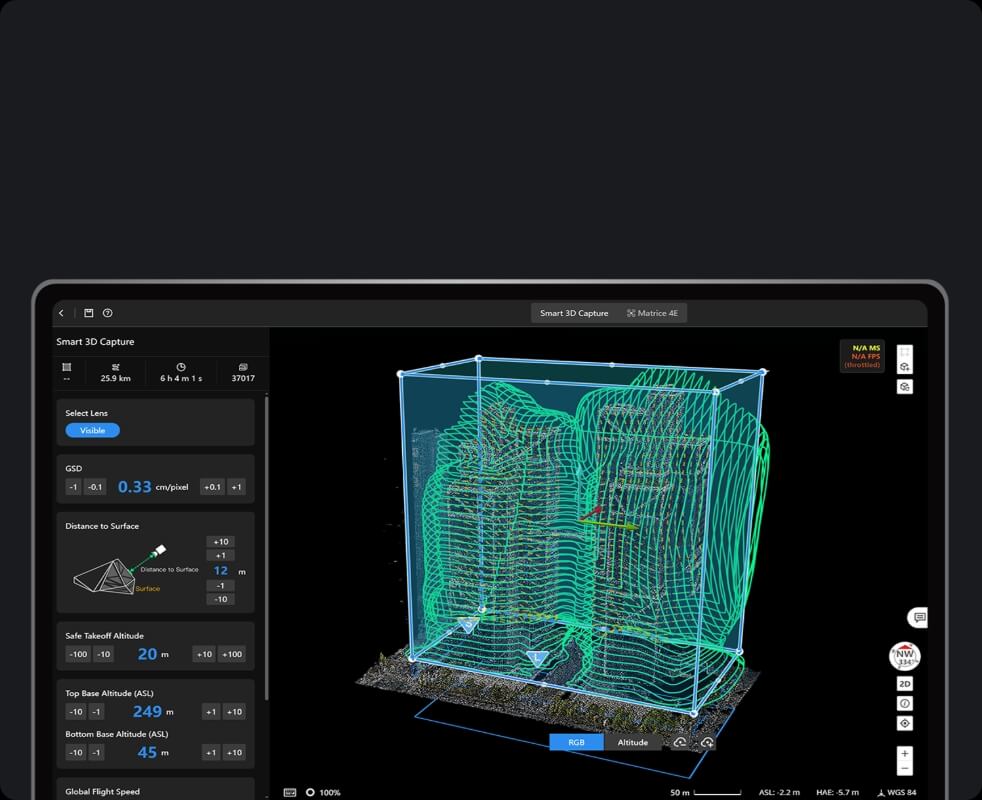
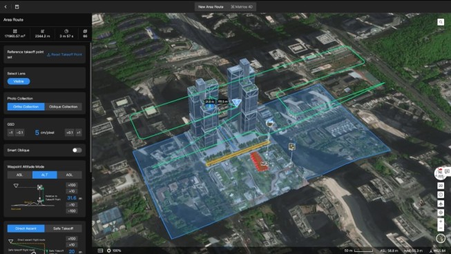
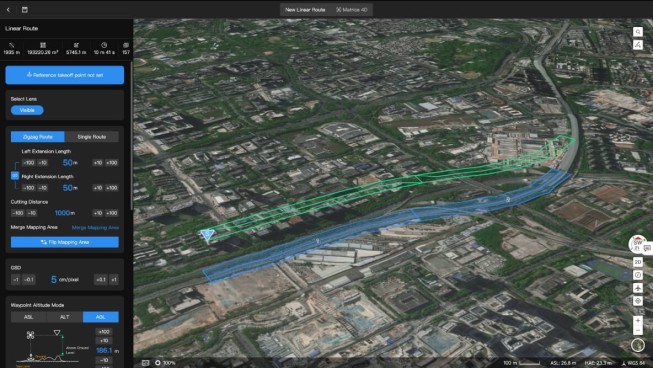
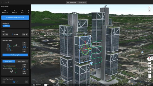
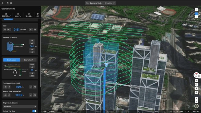
Immersive 3D Route Editing: What You See Is What You Get
Rivers, pipelines, transmission lines, and road corridors don’t fit neatly into area grid patterns. Linear route planning handles them directly optimised for long continuous features and equipped with intelligent segmentation that breaks extended mapping runs into multiple connected flight missions. Each segment hands off cleanly to the next, producing consistent data across the full corridor length.
Onboard detection algorithms identify and count vehicles, vessels, and other defined objects in the live feed and recorded imagery without manual review. For specialised detection requirements, third-party algorithms integrate directly into the same detection pipeline so industry-specific needs are covered without rebuilding the workflow from scratch.
Generalized Intelligent Detection: Enhanced by Multimodal LLM
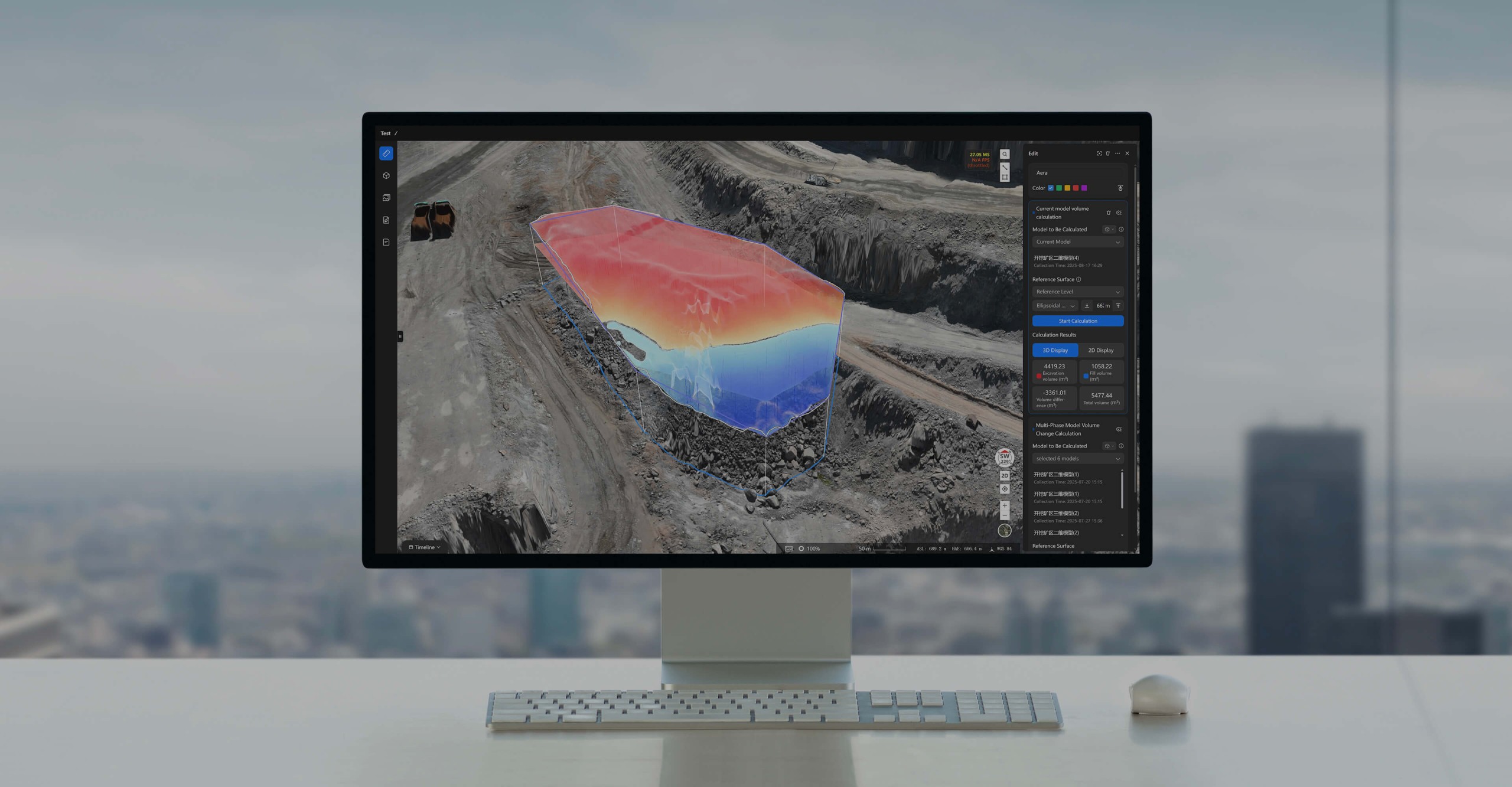
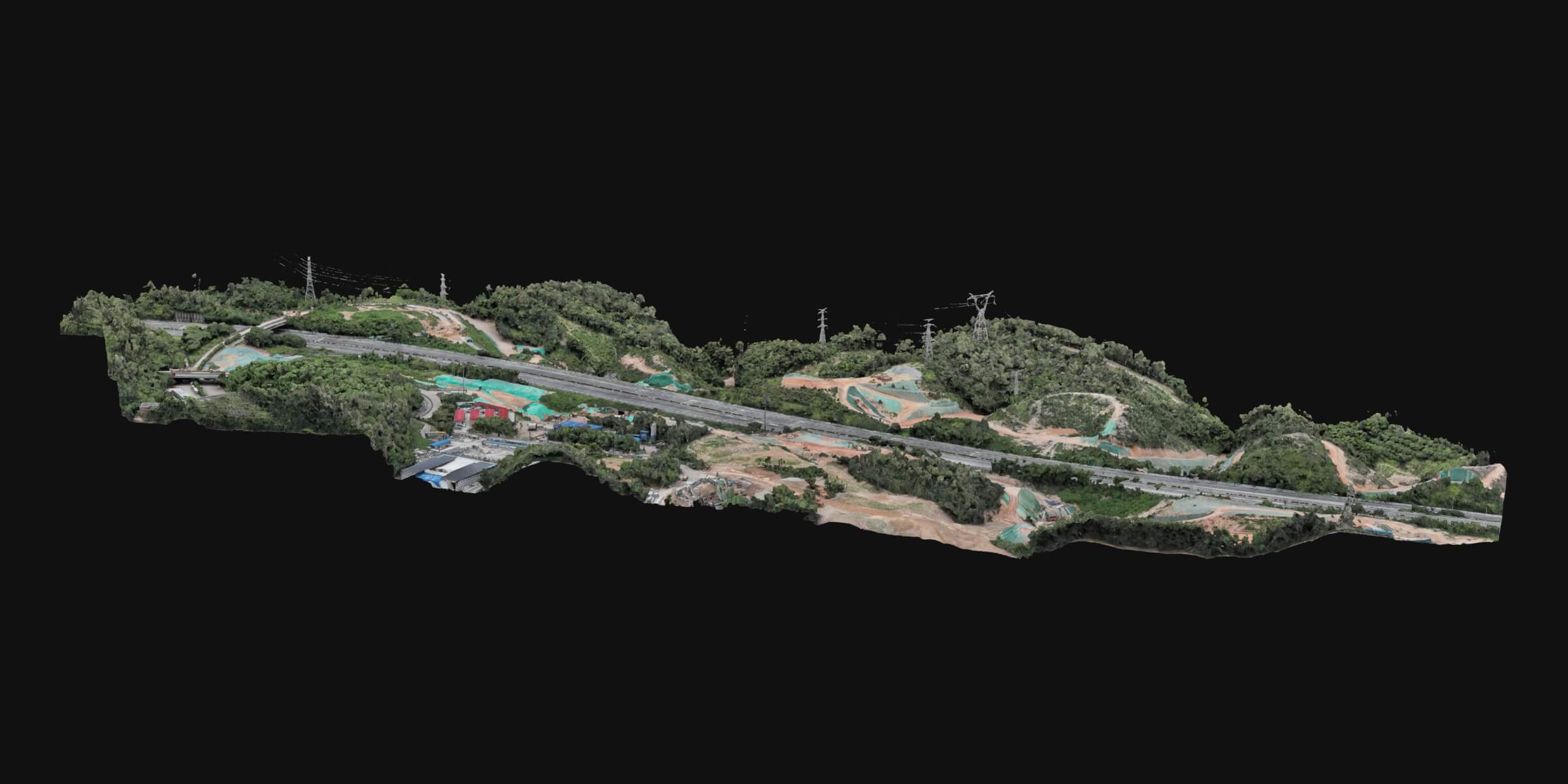
light data uploads directly to FlightHub 2 and reconstruction begins in the cloud producing 2D orthomosaics, 3D reality models, and point clouds without requiring dedicated workstation processing. For missions where time to data matters, real-time 2D reconstruction runs during the flight itself, so a working model is available the moment the aircraft lands. Output accuracy meets 1:500 scale mapping standards, and exports in standard industry formats mean the results plug directly into GIS, BIM, and asset management platforms without conversion steps.
CAD drawings and design documents in PDF and DXF format import directly into the Analyzer and overlay onto the corresponding reality model using coordinate transformation tools. The alignment between design intent and physical site conditions becomes visible in a single view without switching between separate applications or exporting data for comparison elsewhere.
The Timeline tool places survey results from different dates against each other in a single interface 2D and 3D models from separate capture sessions align chronologically so that change over time becomes directly visible. Progress tracking, structural movement monitoring, and environmental change assessment all work from the same temporal analysis view without requiring separate comparison tools.
Once operation results are automatically uploaded to DJI FlightHub 2, users can quickly analyze and annotate the results using comparison and annotation features. Operation photos are displayed at their corresponding geographic locations, aiding personnel in quickly reaching the site of any issues.
Two sets of aerial imagery or 2D orthomosaics sit side by side on the same screen with annotations that display synchronously across both views. The comparison is direct and visual what changed, where it changed, and how significant the difference is all become apparent without building a separate analysis workflow. The map interface keeps the spatial context visible alongside the comparison.
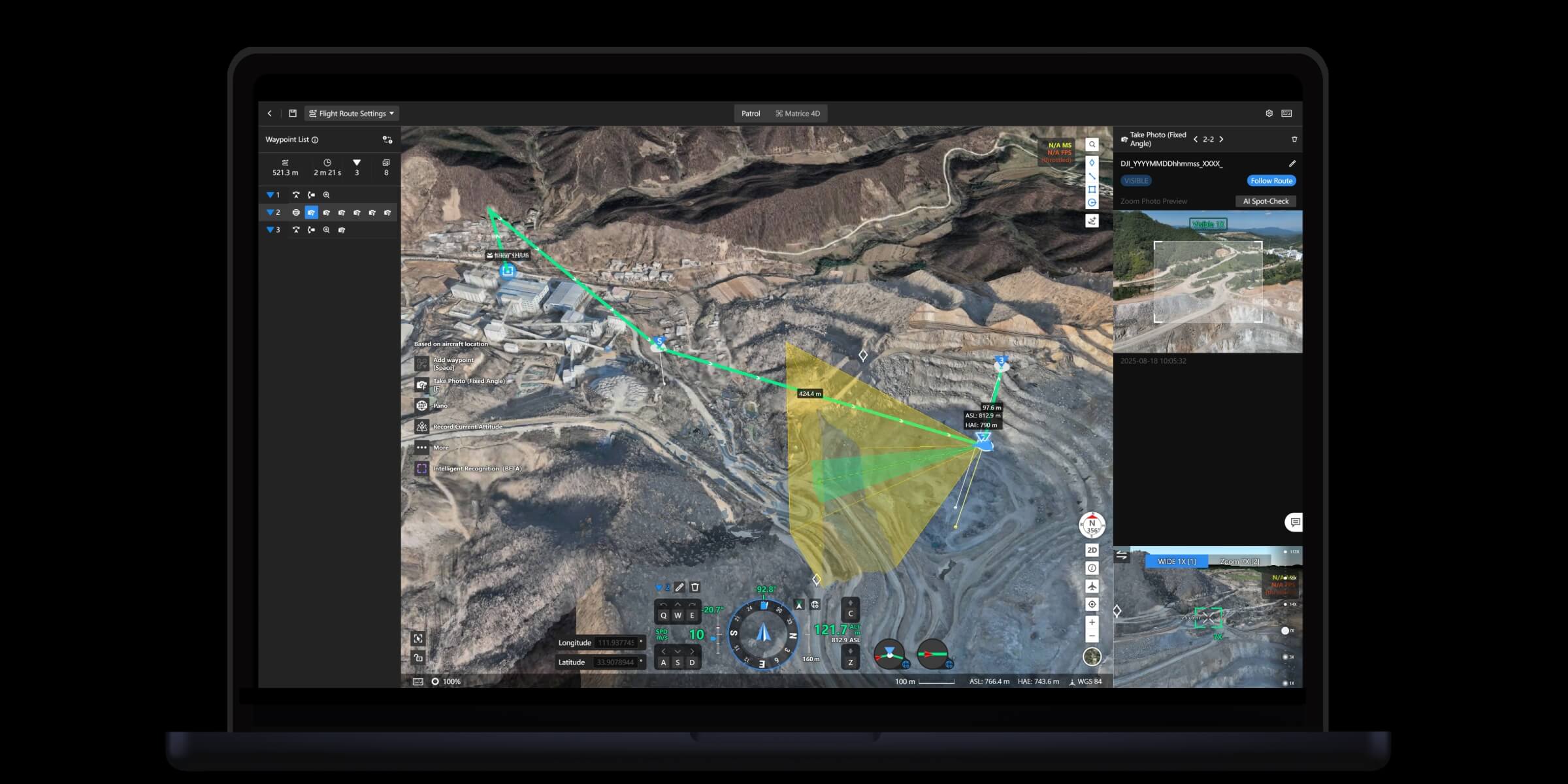
Supports multiple route planning methods to flexibly adapt to complex terrain and diverse operational requirements.
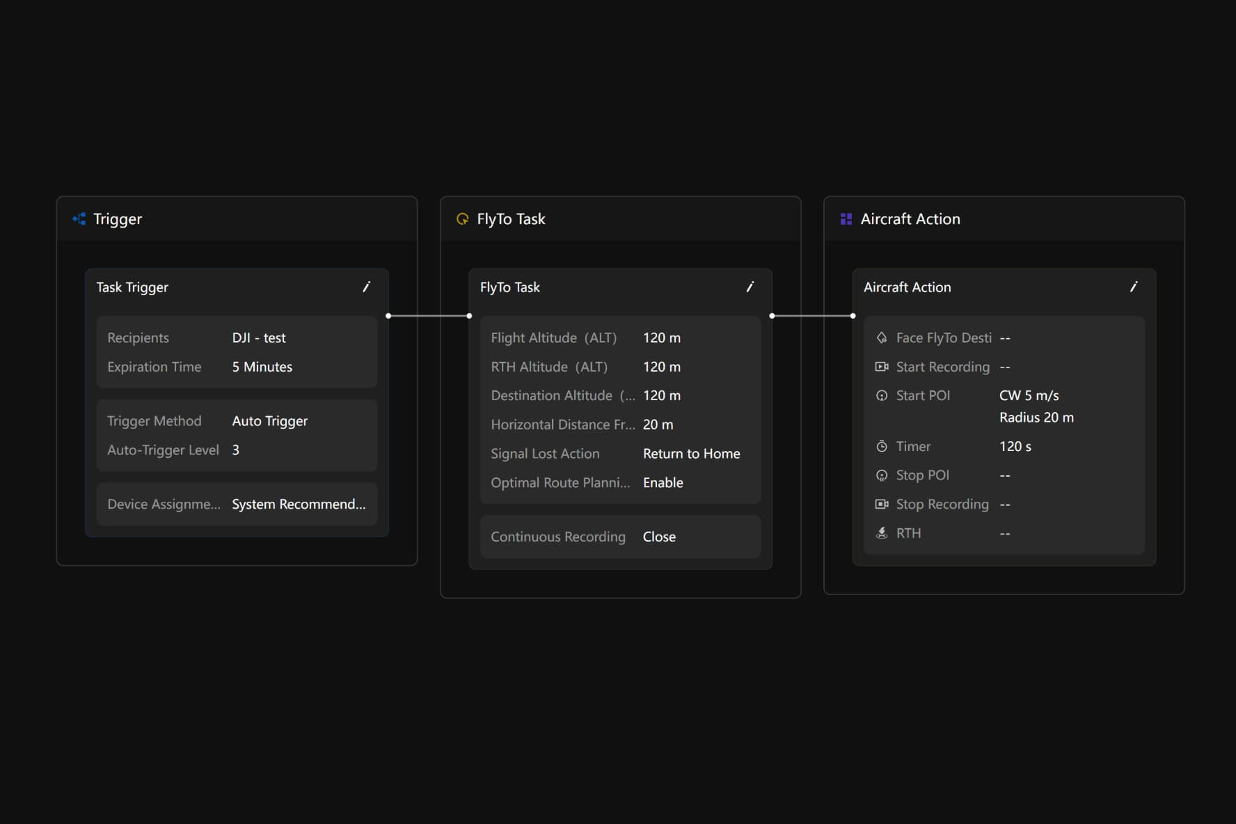
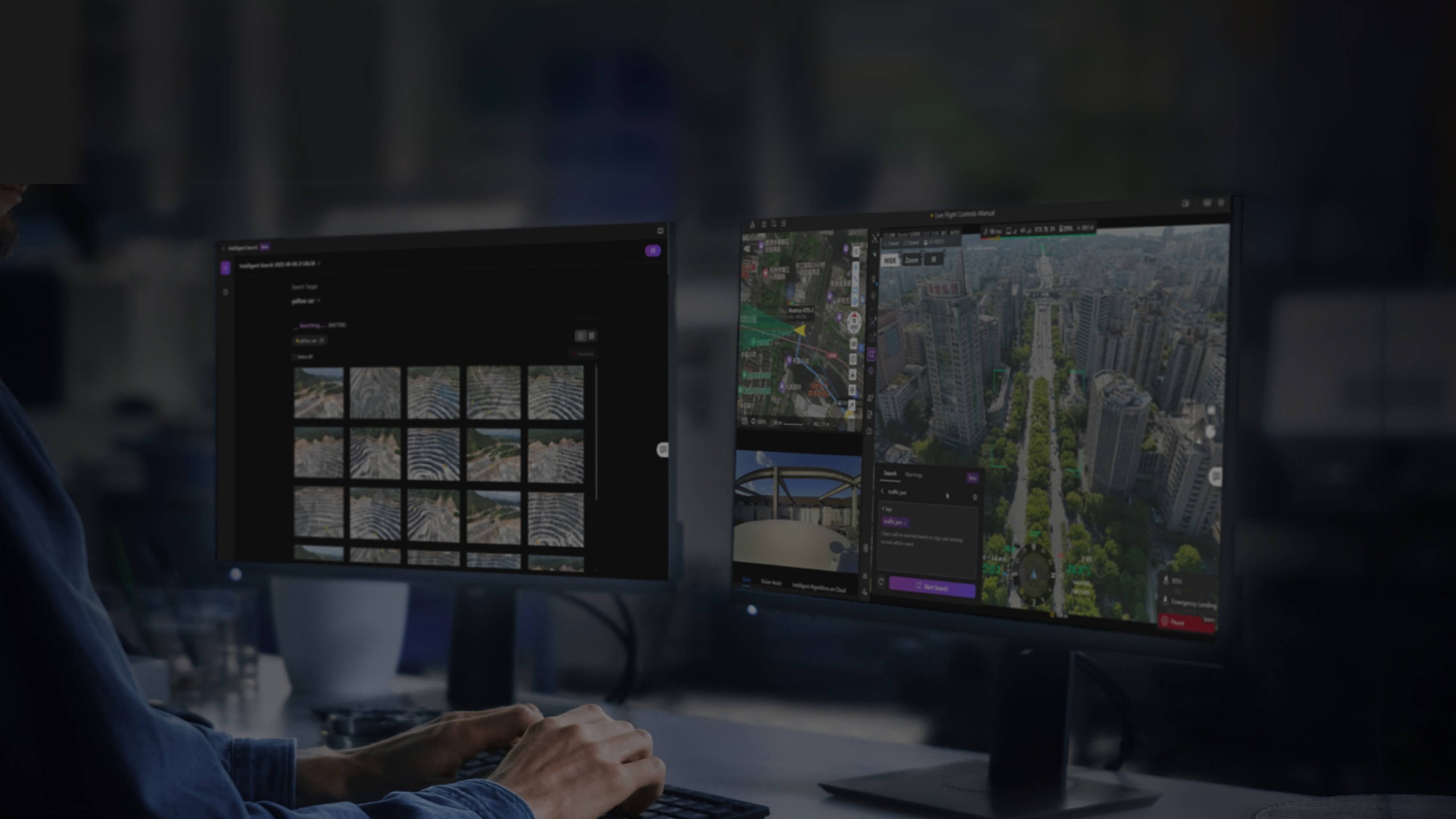
When a detection alert fires, FlightHub 2 can dispatch an aircraft to the relevant location automatically or await operator confirmation the response mode is configurable based on the scenario. Three linked nodes define the sequence: the Trigger that starts the chain, the FlyTo Task that moves the aircraft, and the Aircraft Action that executes on arrival. For law enforcement dispatch, emergency response, and scheduled patrol coverage, this chain converts an alert into an aerial response without manual coordination at each stage.
Recurring data collection programs weekly site surveys, regular infrastructure monitoring, periodic environmental assessments configure through a drag-and-drop workflow builder that chains collection, reconstruction, measurement, analysis, and report delivery into a single scheduled sequence. Once the workflow is set up, the entire cycle runs on schedule without manual intervention at any stage. Hardware and software run in coordination, and the output at the end of each cycle is analysis-ready data and a formatted report, not a raw pile of imagery waiting for processing.
Different team members need different levels of access planners, pilots, reviewers, and administrators each have distinct responsibilities that shouldn’t overlap. Custom role and permission settings define exactly what each user can see, modify, or execute within a project, keeping operations orderly and preventing unauthorised changes to routes, settings, or data.
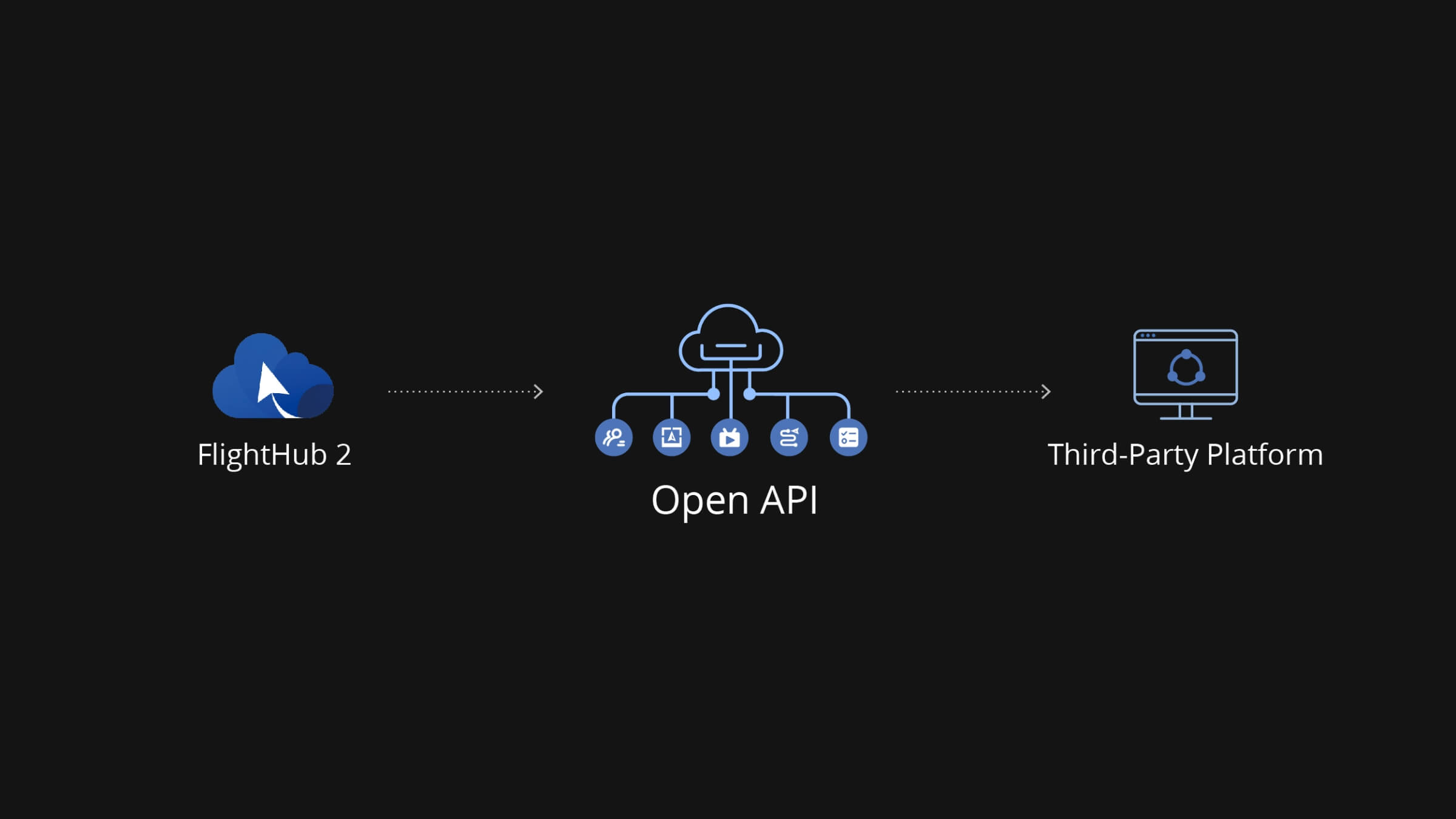
A RESTful OpenAPI exposes FlightHub 2’s core capabilities flight control, mission management, reconstruction, and data access to external development teams. Organisations building custom dashboards, integrating drone data into existing enterprise systems, or adding aerial data collection to industry-specific platforms can build against the API directly, reducing the scope of custom development required and accelerating deployment timelines.
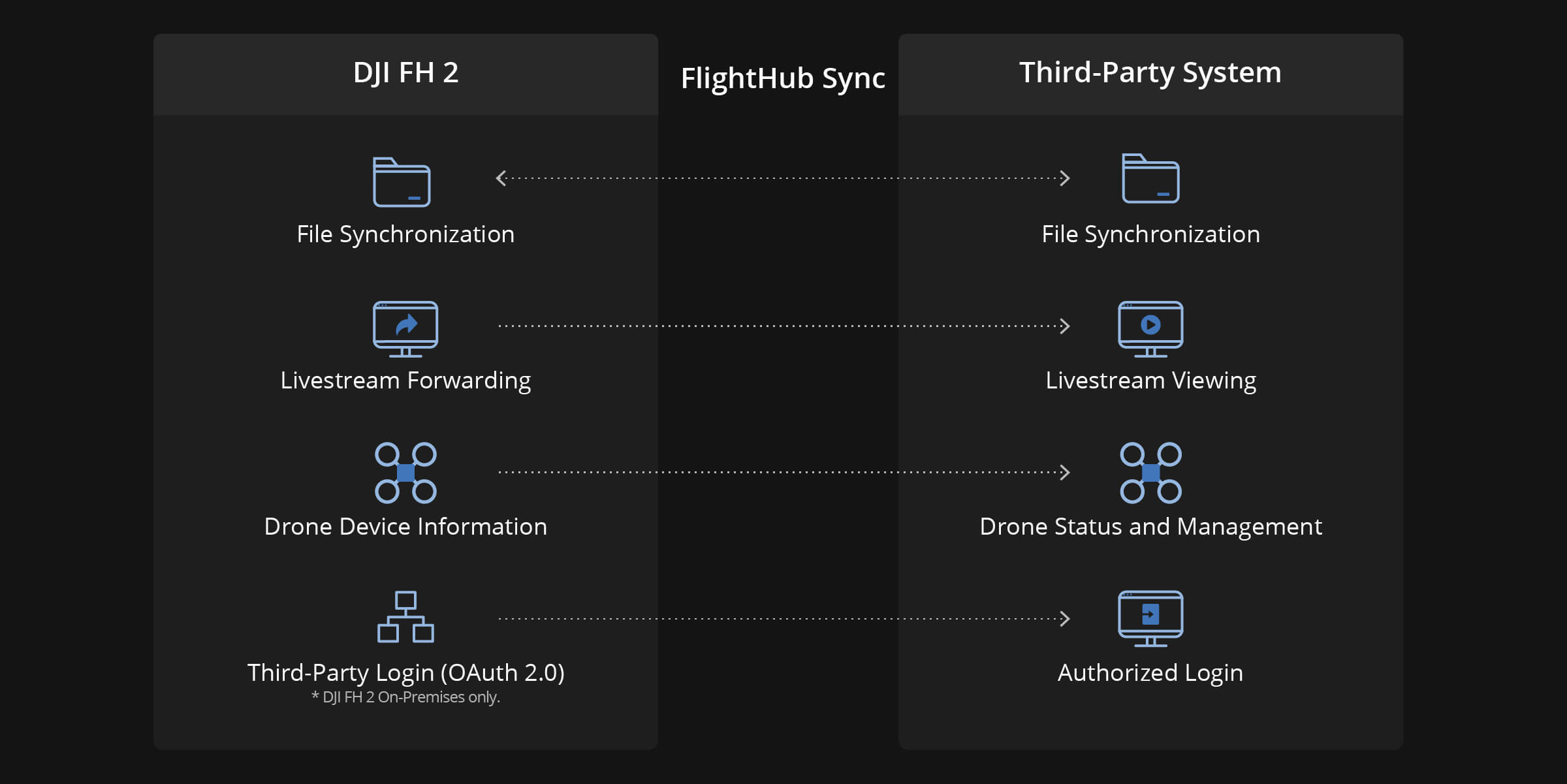
For teams that need system integration without a development build, FlightHub Sync connects FlightHub 2 to existing organisational platforms through a visual configuration interface no code required. Flight routes, media files, and 3D models sync to connected systems automatically. Live streams push to external platforms via RTMP, RTSP, or GB28181 protocol, reaching command centres, client dashboards, and third-party monitoring systems in whatever format they already accept.
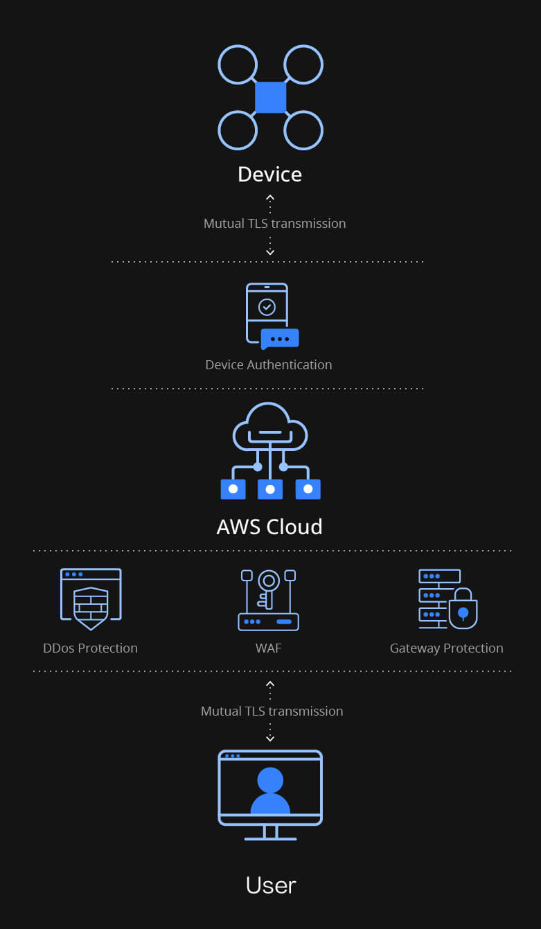
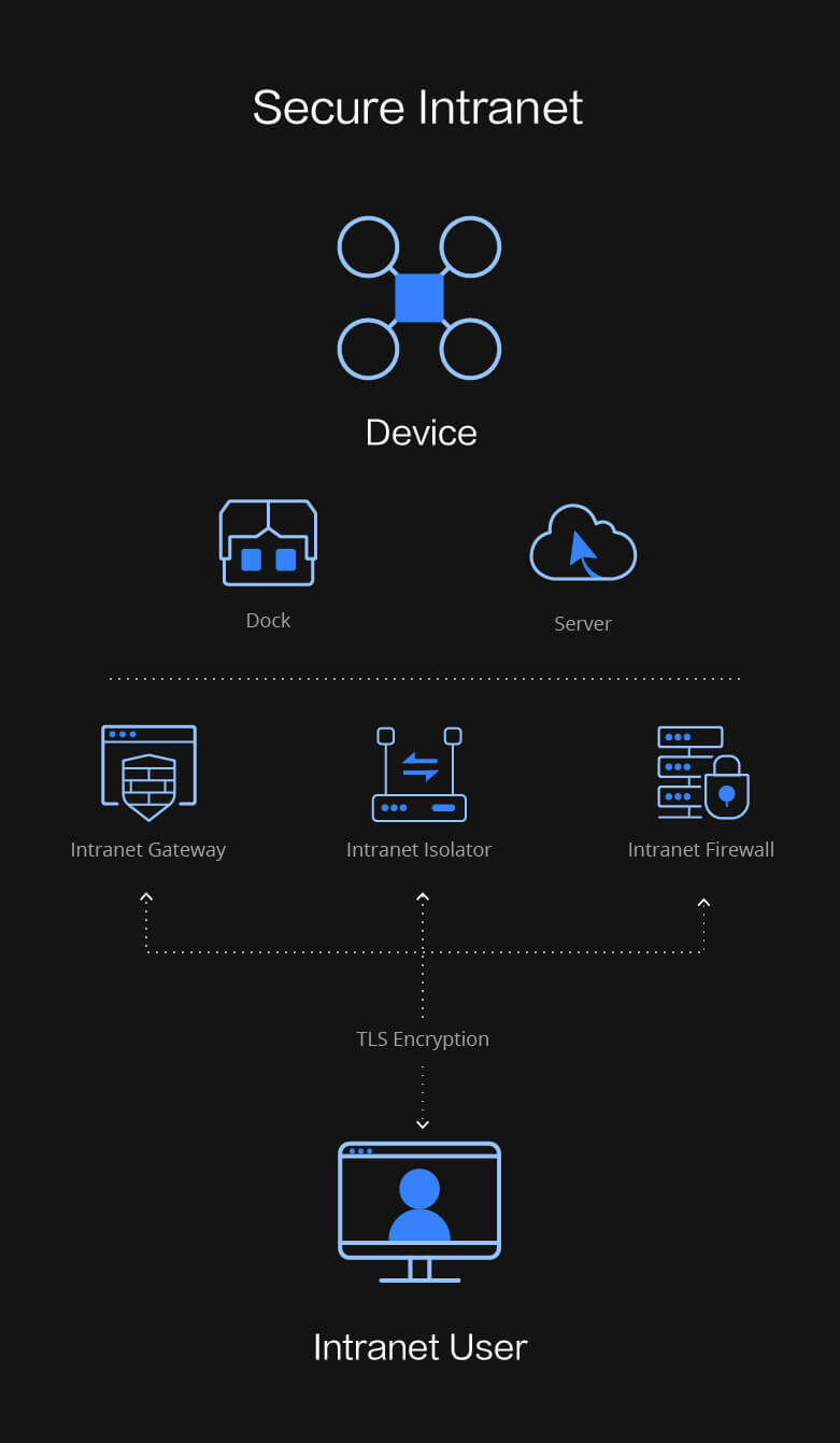
For organisations where cloud deployment raises data sovereignty or network security concerns, FlightHub 2 deploys on-premises into an isolated intranet environment. The same platform capabilities run entirely within the organisation’s own infrastructure, with no data leaving the internal network. An All-in-One solution is available for organisations that need self-contained deployment without building a dedicated server environment.
Device Binding and Free Quotas: Upon initially binding devices to an organization, corresponding livestream minutes, mapping image quotas, and storage space will be granted.
FAQ| Differences | Standard Version (Free) |
Business Version | Enterprise Version | On-Premises Version (AIO Included) |
|---|---|---|---|---|
| Livestream | — |
2000 minutes/month Unused minutes roll over |
Unlimited duration Limited dock livestream |
Unlimited duration |
| Storage Capacity | 5 GB | 500 GB | Unlimited | Unlimited |
| Mapping Quantity | — | 3000 images/month | 150,000+ images/year | Unlimited |
| Max Online Devices | Unlimited | Unlimited | Based on package | Up to 200 devices |
| Account Quantity | 5 | Unlimited | Unlimited | Unlimited |
| Custom Roles | — | ✔ | ✔ | ✔ |
| Smart Search | 4/month | Unlimited | Unlimited | Unlimited |
| Analyzer | Demo only | ✔ | ✔ | ✔ |
| Auto Dispatch | — | ✔ | ✔ | ✔ |
| OpenAPI | ✔ | ✔ | ✔ | ✔ |
If livestream minutes are insufficient, you may purchase this package, which is valid for one year.
If mapping image quota is insufficient, you may purchase this package, which is valid for one year.
If storage space has reached its limit, you may purchase this package, which is valid for one year.
Your journey into the extraordinary begins here. Share your details for a personalized DJI FlightHub 2 quote and let your imagination soar.
✅ Thank you for reaching out. Your message has been successfully sent, and our team will get in touch with you shortly.