Aerosmart Drones | All types drones

Aerosmart UAV Trading L.L.C. is a tech company that specialises in drones and solutions in the UAE and across the GCC.

Our Office

Office 203, Al Tayer Commercial Building,
Rolla Street, Bur Dubai, UAE

Follow Us

The ultimate desktop solution for turning any aerial or terrestrial capture into precision geospatial data and clean, CAD-ready vectors

Are you ready to go big?

From raw capture to CAD and GIS-ready deliverables, combine large-scale processing and survey-grade extraction in a single workflow.

A seamless path to CAD/GIS

A seamless path to CAD/GIS

All in one workflow. Process your data and finish your survey work in the same workspace. No switching tools, no breaking context, just a smooth path from capture to deliverables.

Process big projects without slowing you down

Process big projects without slowing you down

Work with large datasets while keeping the level of accuracy. You can process more data in less time, without splitting projects or cutting corners.

Measurements you can trust

Measurements you can trust

Create terrain models, vectors, and volume calculations directly on the processed data. Results stay consistent and reliable, even on complex sites.

Outputs ready for CAD and GIS

Outputs ready for CAD and GIS

Export clean, well-structured files that drop straight into CAD or GIS software. No rework, no extra formatting, just files that are ready to use.

Built for the Pix4D ecosystem

Built for the Pix4D ecosystem

Capture with PIX4Dcatch, process and extract with PIX4Dmatic, then export it to PIX4Dcloud for sharing and collaboration. A connected workflow that keeps data consistent from the field to the office and beyond.

Integrated processing and surveying workflow

Essential outputs, in a fraction of the time

without compromising accuracy

Point cloud

Point Cloud

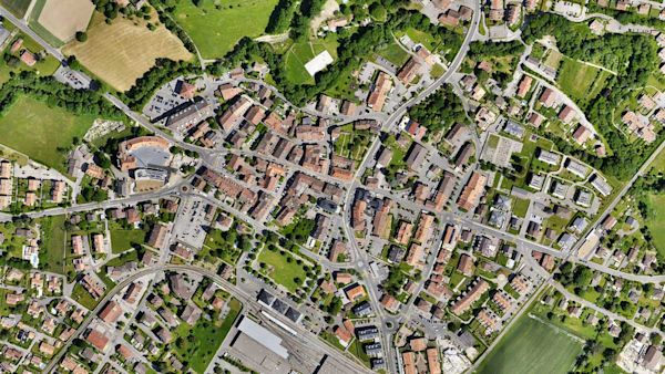
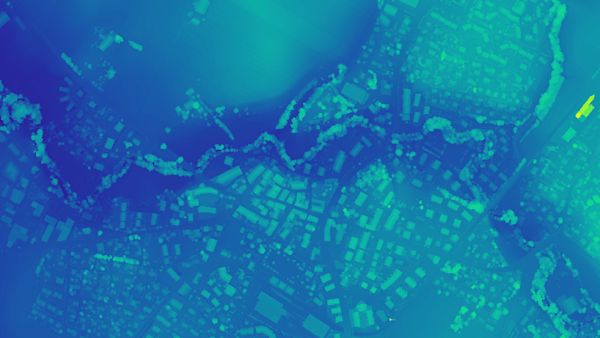
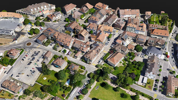
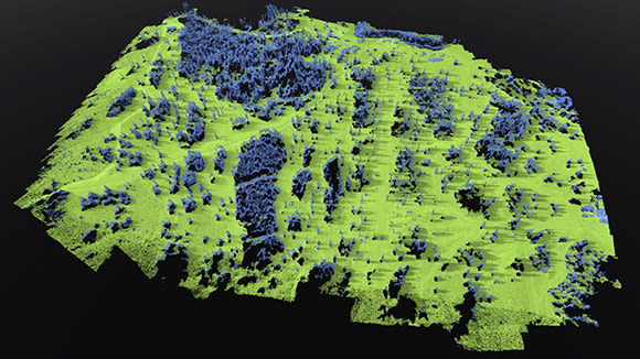
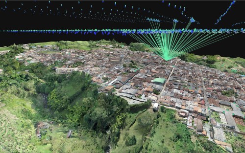
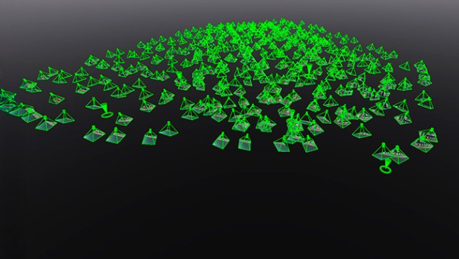
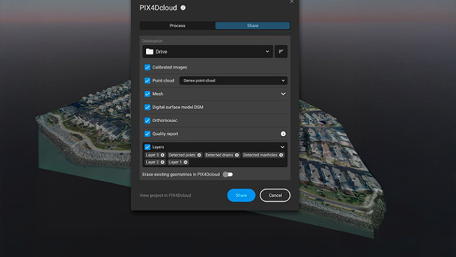
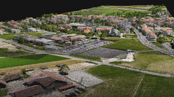
Generate a dense point cloud, create a depth point cloud or fuse them according to the needs of your project and create the best reconstruction possible.

Export formats:
  • .laz
  • .las
  • .xyz

Orthomosaic

Orthomosaic

Create orthomosaics that are geometrically corrected such that the scale is uniform. They are color balanced in order to be visually pleasing.

Export formats:
  • .tiff (GeoTIFF)
  • .jpg (Georeferenced with .jgw)
  • .tfw
  • .prj

Digital surface model (DSM)

Orthomosaic

Generate a digital representation of all objects in the mapped area. It includes natural features as well as elevated objects, like buildings.

Export formats:
  • .tiff (GeoTIFF)

Mesh

Point Cloud

Generate a 3D textured mesh by defining the texture size and decimation criteria and view it either in textured or shaded mode.

Export formats:
  • .obj
  • .slpk
  • Cesium 3D Tiles
  • .laz
  • .fbx

Terrain classification

Orthomosaic

Classify point cloud data into ground and non-ground classes to support accurate terrain modelling and survey analysis.

Export formats:
  • .LAS (.las)
  • .LAZ (.laz)

Digital terrain model (DTM)

Point Cloud

Generate a digital terrain model (DTM) by filtering non-terrain points to represent the bare earth surface, suitable for engineering analysis and survey workflows.

Export formats:
  • .tiff (GeoTIFF)

TIN

Orthomosaic

Generate a terrain TIN by classifying ground points and defining surface resolution, then visualise it as a structured triangulated surface for terrain analysis and measurements.

Export formats:
  • .LandXML
  • .GeoTIFF format (.tif)

Contour lines

Point Cloud

Generate contour lines directly from terrain models at defined intervals for mapping and survey deliverables.

Export formats:
  • .dxf
  • .shp

PIX4Dmatic is changing the face of surveying and mapping

Drone mapping a 1,500-acre golf course with PIX4Dmatic

Drone mapping a 1,500-acre golf course with PIX4Dmatic

For high precision and speed, a land surveyor used PIX4Dmatic to map a large golf course in just three weeks, processing over 11,000 images

PIX4Dmatic highlights 2025

PIX4Dmatic highlights 2025

A new orthomosaic editor, combine LiDAR point clouds with drone data, LandXML volume calculations, more accurate vector drafting & more!!

Cadastral digitization made easy with PIX4Dmatic

Cadastral digitization made easy with PIX4Dmatic

Processing and validating data for a cadastral survey with PIX4Dmatic reduced weeks of work to hours, minimizing time spent on-site!

Request for a Quote

Your journey into the extraordinary begins here. Share your details for a personalized PIX4Dmatic quote and let your imagination soar.