Aerosmart UAV Trading L.L.C. is a tech company that specialises in drones and solutions in the UAE and across the GCC.
Aerosmart UAV Trading L.L.C. is a tech company that specialises in drones and solutions in the UAE and across the GCC.
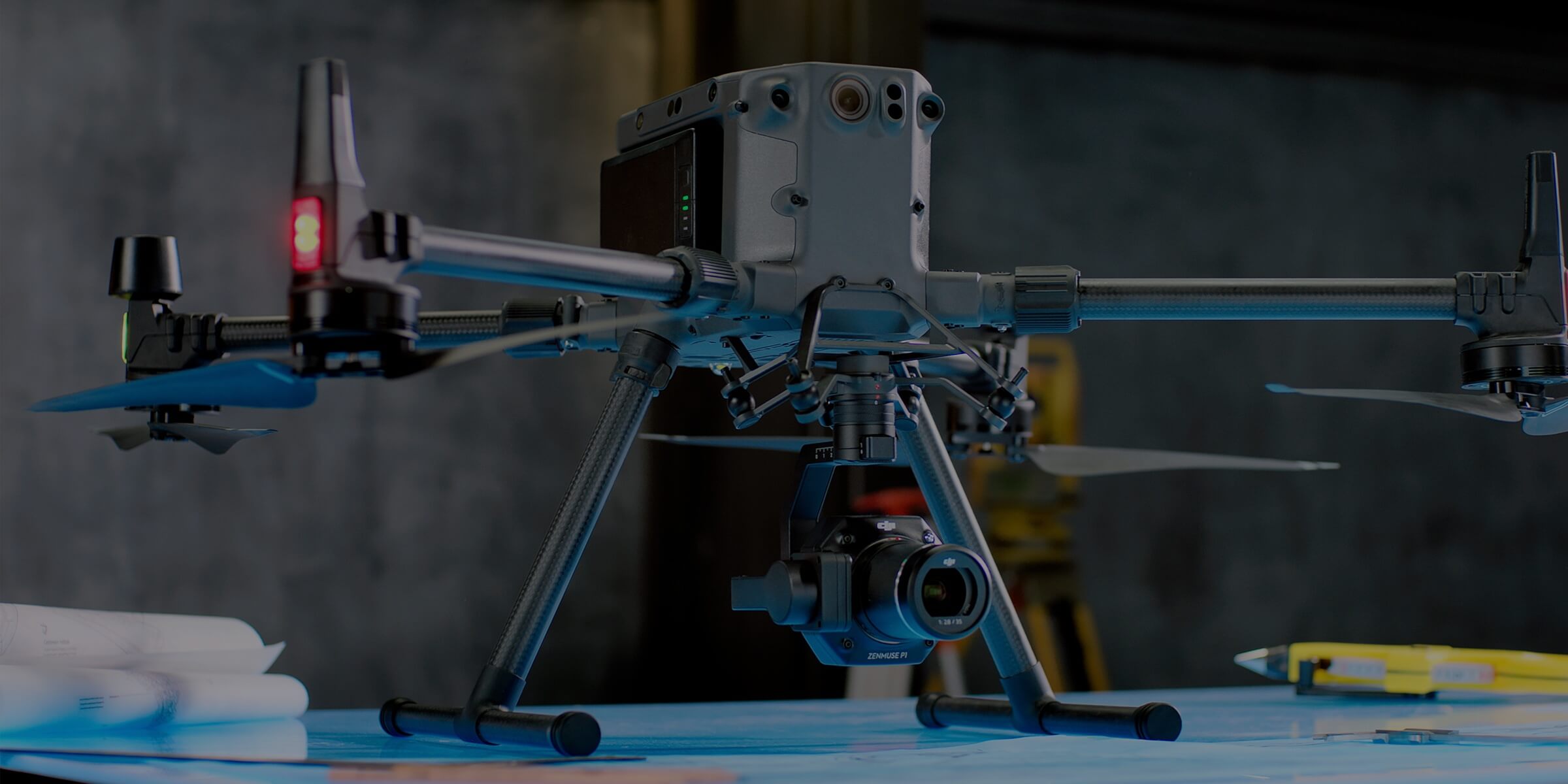
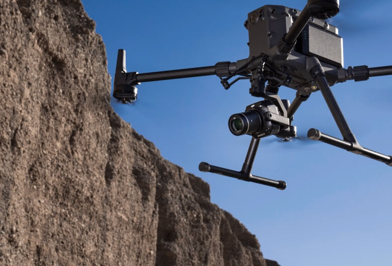
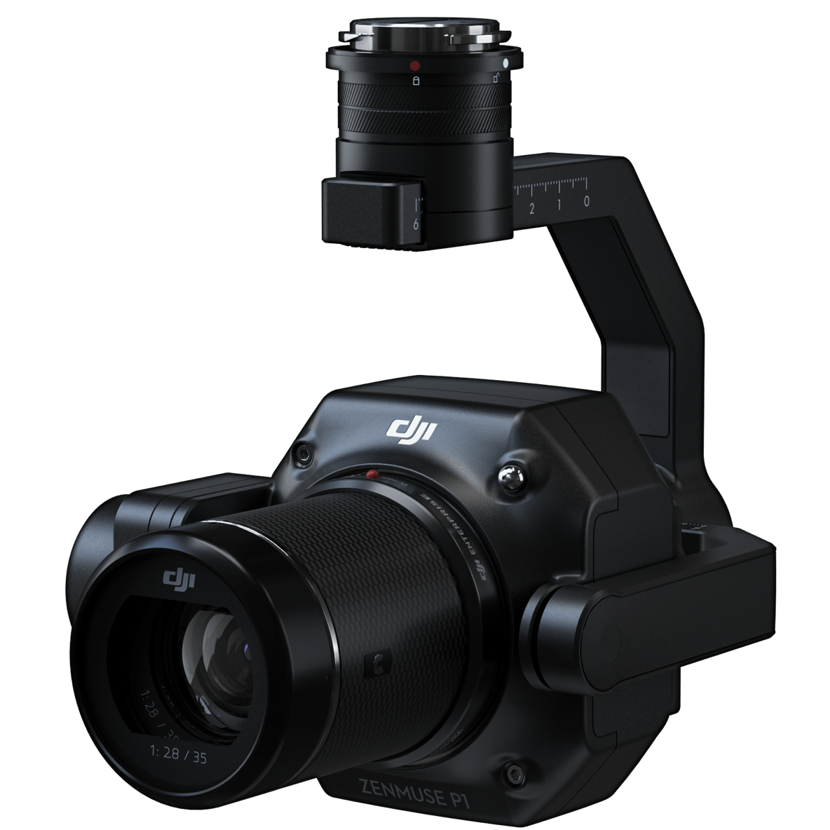
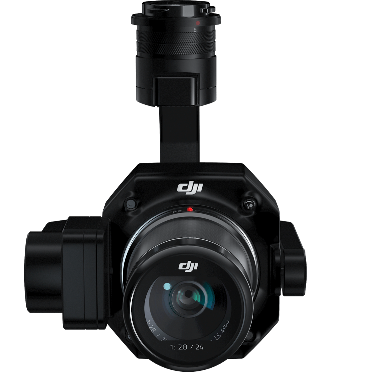
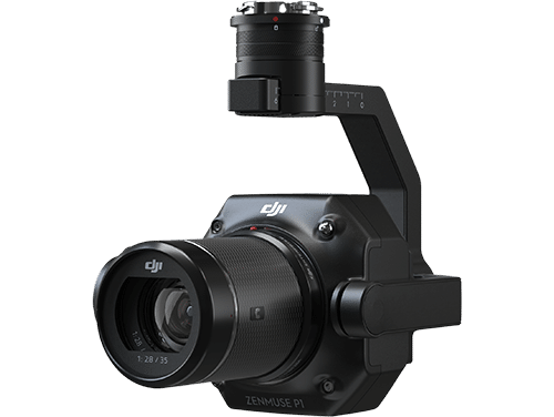
The Zenmuse P1 integrates a full-frame sensor with interchangeable fixed-focus lenses on a 3-axis stabilized gimbal. Designed for photogrammetry flight missions, it takes efficiency and accuracy to a whole new level.

Accuracy without GCPs
3 cm horizontally / 5 cm vertically

High Efficiency
3 km² covered in a single flight

45 MP Full-frame Sensor

3-axis Stabilized Gimbal
Smart Oblique Capture

Global Mechanical Shutter
Shutter Speed 1/2000 Seconds

TimeSync 2.0 – synchronization
at the microsecond level
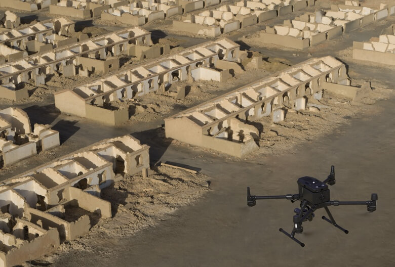
The P1 includes a full-frame, low-noise high-sensitivity sensor that can take a photo every 0.7 s during the flight, and covering 3 km² in a single flight.
Equipped with a global mechanical shutter and the all-new TimeSync 2.0 system, which synchronizes time across modules at the microsecond level, the Zenmuse P1 lets users capture centimeter-accurate data combined with real-time position and orientation compensation technology.
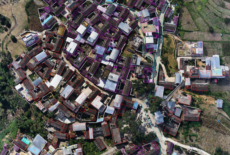
Create 2D, 3D, and detailed models thanks to the integrated 3-axis gimbal that can be outfitted with 24/35/50mm lenses and the Smart Oblique Capture feature.
Cover 7.5 km² in a single workday with the P1. Elevate the efficiency of your oblique photography mission using Smart Oblique Capture, where the gimbal automatically rotates to take photos at the different angles needed. Only photos essential to the reconstruction will be taken at the edge of the flight area, increasing the efficiency of post processing by 20% to 50%.
Your mission data management – streamlined.
Mission result files are automatically associated with the Mission Name and Mission Time.
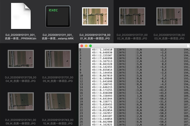
A centralized storage location for photos, GNSS data, and TimeStamps.MRK files.
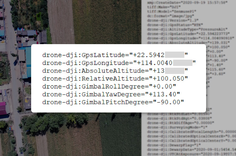
The image metadata contains the camera’s intrinsic and extrinsic parameters and the status of RTK.
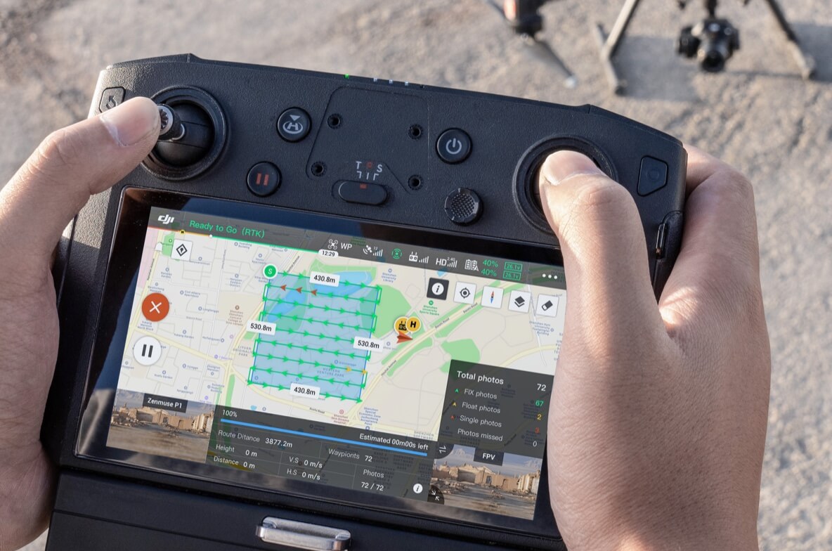
Verify data quality immediately post-flight by checking the position data and number of the images acquired, as well as RTK status and positioning accuracy.


Your journey into the extraordinary begins here. Share your details for a personalized DJI Zenmuse P1 quote and let your imagination soar.