
Aerosmart UAV Trading L.L.C. is a tech company that specialises in drones and solutions in the UAE and across the GCC.
Aerosmart UAV Trading L.L.C. is a tech company that specialises in drones and solutions in the UAE and across the GCC.

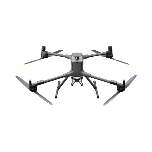
Weight: 1219 g (with propellers)
Max Flight Time (without wind): 49 minutes
Environment Adaptability: Max takeoff altitude 6000 m, max wind speed resistance 12 m/s
Sensing System: Omnidirectional binocular vision system, supplemented with a 3D infrared sensor at the bottom of the aircraft
Wide-Angle Camera: 1/1.3-inch CMOS, 48MP effective pixels (Matrice 4T)
Medium Tele Camera: 1/1.3-inch CMOS, 48MP effective pixels
Telephoto Camera: 1/1.5-inch CMOS, 48MP effective pixels
Infrared Thermal Camera: 1280 × 1024@30fps (Super Resolution enabled, Night Mode not activated)
Laser Rangefinding: 1800m measurement range (1 Hz) @20% reflectivity target
Learn more ›
Ground control
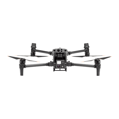
Weight (incl. two batteries): 3770 ± 10 g.
Max Flight Time: 41 min.
Sensing system: Six-directional sensing and positioning.
Environment Adaptability: Max Service Ceiling Above Sea Level (without other payload) 7,000 m (with 1676 propellers); Max Wind Resistance 12 m/s.
Zoom camera: 1/2-inch CMOS, Effective pixels: 48MP.
Learn more ›
Drone and dock’s cloud management system
Learn more ›Ground control
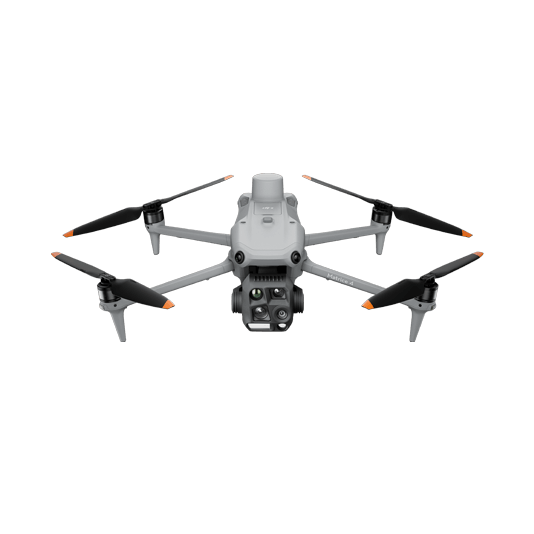
Weight: 1219 g (with propellers)
Max Flight Time (without wind): 49 minutes
Environment Adaptability: Max takeoff altitude 6000 m, max wind speed resistance 12 m/s
Sensing System: Omnidirectional binocular vision system, supplemented with a 3D infrared sensor at the bottom of the aircraft
Mechanical Shutter Speed: 2-1/2000 s, minimum photo interval 0.5 s
Wide-Angle Camera: 4/3-inch CMOS, 20MP effective pixels
Medium Tele Camera: 1/1.3-inch CMOS, 48MP effective pixels
Telephoto Camera: 1/1.5-inch CMOS, 48MP effective pixels
Laser Rangefinding: 1800m measurement range (1 Hz) @20% reflectivity target
Learn more ›Ground control

Modeling and flight mission plan
Learn more ›✅ Thank you for reaching out. Your message has been successfully sent, and our team will get in touch with you shortly.