
Aerosmart UAV Trading L.L.C. is a tech company that specialises in drones and solutions in the UAE and across the GCC.
Aerosmart UAV Trading L.L.C. is a tech company that specialises in drones and solutions in the UAE and across the GCC.

Africa has advanced in various areas, including construction, mining, farming, land development and more. Hence, these industries needed improved methodologies to enable effective visualisation of land, spatial measurements, and planning work.
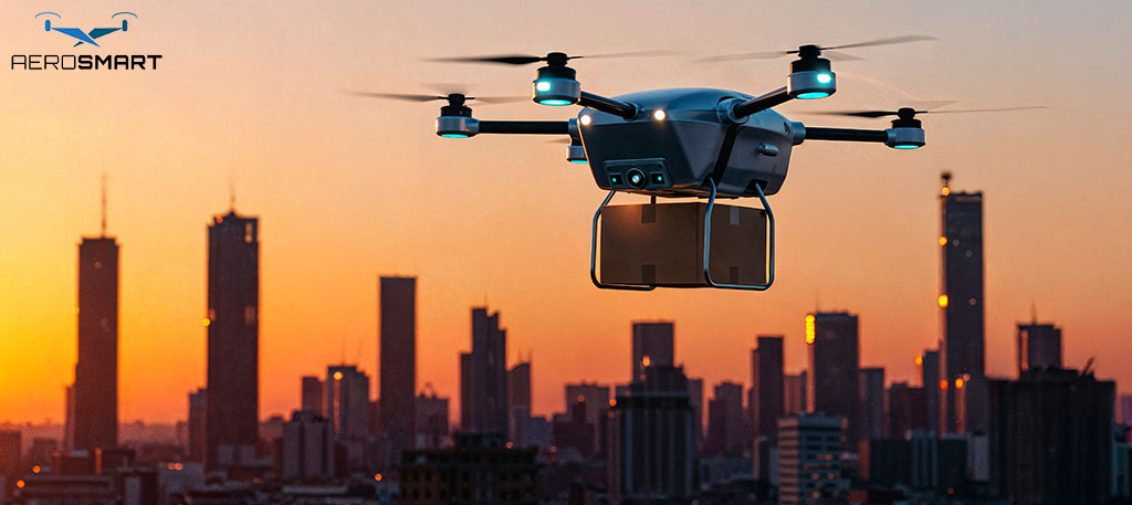
This has opened up opportunities for the development of drone technology, which is the future of the coming years. Nowadays, drones no longer serve the traditional function of a flying camera; they have, however, evolved into smart devices that enable faster, safer, and better work.
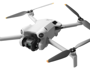
These days, nearly all companies seek a trusted drone dealer in Africa to get sound products with proper support. Apart from that, there is an increased demand for such simple-to-use solutions, such as a mapping drone. These drones help organisations understand the land, monitor progress, and avoid errors.
With DJI propelling global drone development, Africa is launching into a future of more innovative aerial technology.
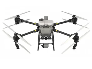
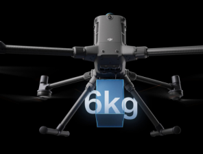
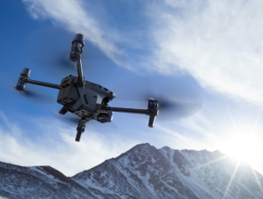
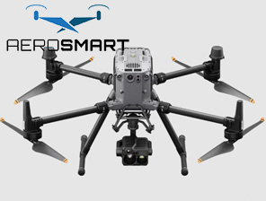
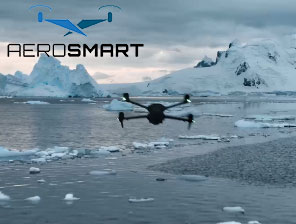
DJI excelled in terms of quality, safety, and innovative drone technology. Harsh environmental conditions, from hot deserts to remote mining sites, have been overcome with DJI Drones to yield stable performance and precise data.
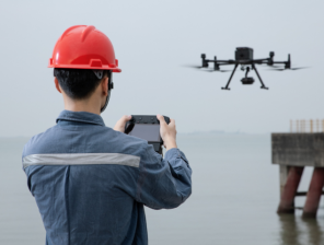
Preventing time waste and risks to employee lives through drones in the mining industry. Some of the most advanced features of DJI Drones for mining include surveying large sites, stockpile inspection, and daily operational monitoring.
Instead of risking sending people into hazardous areas, analysing data from above is now a way to improve safety while enhancing planning.
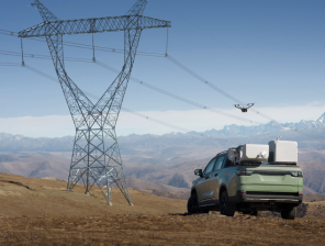
Companies also use uncrewed aerial vehicles across several geographies to manage land projects and infrastructure, as the right drone solution helps teams understand ground conditions before work commences, directly translating into fewer delays and cost surprises.
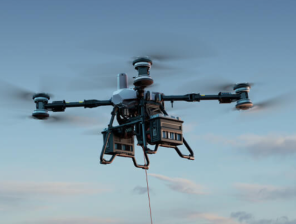
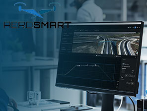
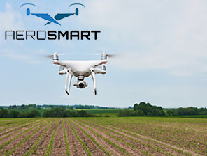
Drone mapping is among the significant applications of drones today. A mapping dronetakes high-quality photographs and uses them to create detailed maps and 3D models. These maps allow engineers, planners, and surveyors to make very realistic decisions.
Statistically speaking, drone mapping can cover a large area in one hour, compared to days, which is essential in Africa, where land areas are primarily large and remote. The drones would fly above and collect data without disturbing the land or the environment. The results are accurate, user-friendly, and long-lasting.
So nowadays, companies all around favour the use of drones because they reduce a lot of manual work and eliminate human error. Thus, aerial mapping will guarantee equal access to information by all parties.
The proper selection of suppliers is equally important as that of drones. Businesses always require after-sales training, service support, and guidance. This is the reason the relationship with a very reputable drone dealer in Africa makes a big difference.
A trusted dealer understands the local rules, climate conditions, and business needs. They therefore help customers select the best drone model and explain how to use it properly. This assurance increases confidence and ensures the drone’s continued value.
As the use of drones continues to expand across Africa, strong local partnerships help technology to reach other industries much faster. From the most minor survey teams to the largest mining companies, everyone benefits greatly from proper guidance and after-sales support.
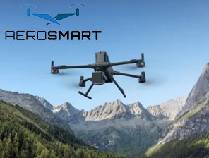
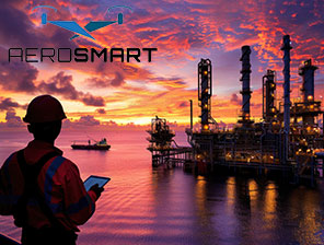
Mining is one of the most challenging industries in Africa. The places are usually massive, remote, and highly dangerous. This is where DJI Drones for Mining come in very handy. They measure land, inspect slopes, and then track materials without putting humans at risk.
Drones enable managers to make quick, real-time decisions while reducing stoppages, as inspections can be performed without stop-work. Over time, productivity has improved, and operating costs have decreased.
In addition, drones are used to meet safety and environmental standards. With high-resolution aerial photographs, mining companies will be able to assess land impact and plan restoration with much greater efficiency.
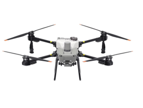
DJI drones can boast ease of handling as one of their main advantages. The drones can be flown by even a person with little training. Software is simple, while controls are intuitive. Thus, drones can serve both large corporations and small teams.
It is essential to understand that mapping only requires a basic level of skill to produce results. Automated flight paths and intelligent sensors do most of the work.
This aspect gives the operator time to meet or perform other functions, such as analysis, rather than being stuck manually flying the drone.
Many people in Africa are learning how to use aerial data most effectively to improve their daily tasks, now that they know a lot about drones. Instead, this creates space for job creation and supports the long-term development of local skills.
Africa’s future now lies within the parameters of intelligent planning and safe operations, which are essential for overall development. Drones make this vision possible through fast, precise, and reliable information. Drones, which are used for mapping land, managing mines, and planning cities, have become indispensable tools.
Demand for more advanced drone solutions will continue to increase. Early adopters of drone technology will demonstrate the fastest, safest, and most cost-efficient way of doing business. DJI’s firm belief in innovation ensures its drones remain usable for many years to come.
Drones are used to track the impact of land use and environmental changes. Land use, in turn, can be easily tracked and planned for restoration activities by mining and construction companies.
Aerial data, therefore, supports environmentally responsible development by helping companies comply with government regulations and thereby protect natural resources.
Drones are very beneficial to businesses as they save both time and money. All these aspects lead to cost reductions. Drones also help increase productivity by providing accurate information from the very beginning.
Early adopters of drone technology inevitably become the early adopters of competitive edges. Projects can be completed more quickly and with greater confidence.
Worker safety is a significant concern in industries such as mining and construction. Drones reduce the need for people to enter hazardous areas. They collect data from the air, reducing risk and preventing accidents. This makes the working environment safer and generates trust and confidence among employees.
It is essential to understand that many large projects are usually challenging to manage, especially when the land spans a wide area. Drones help managers see everything from one place. A clear aerial view makes it easier to plan work, track progress, and avoid confusion.
The use of aircraft drones can lead to the massive collection of aerial data, which can then improve planning, construction, and management systems. Now, with the embrace of drone solutions across diverse industries, Africa is getting closer to a connected, technology-driven future.
A very bright and promising future awaits aerial solutions on the African continent. The confidence built in these aerial applications ought to make drone technology very valuable in industries, including mining safety and intelligent land mapping. With products like DJI Drones, companies make better decisions while reducing their risk.
Emerging as a firm to reckon with in Africa, Aerosmart.ae is gaining a better reputation for providing advanced DJI drone solutions, reliable products, and support as a business partner for growing businesses and for ensuring success with modern aerial technology.
FAQs
Why DJI drones are so popular for mining operations in Africa?
They survive tough conditions, cut survey costs, keep workers safer and give accurate site data that helps planning. They check dangerous spots like steep slopes and material piles from above so people don’t risk going there.
What data do mining drones collect during site surveys?
Photos, height measurements, pile sizes, ground maps and heat readings that give complete information about the site.
How much faster is drone surveying compared to traditional methods?
Drones finish in hours what ground crews need weeks to complete. They’re roughly five times quicker overall.
What is photogrammetry in drone mapping?
It connects hundreds of overlapping photos to build flat maps and height models showing what the ground looks like.
How accurate are drone maps for construction and mining projects?
Professional mapping drones hit two to three centimetre accuracy with control points, matching what surveyors need.
Why should African businesses choose authorised drone dealers?
Authorised sellers provide training, fix problems, honour warranties and help pick the right equipment for each job.


✅ Thank you for reaching out. Your message has been successfully sent, and our team will get in touch with you shortly.