Aerosmart Drones | All types drones

Aerosmart UAV Trading L.L.C. is a tech company that specialises in drones and solutions in the UAE and across the GCC.

Our Office

Office 203, Al Tayer Commercial Building,
Rolla Street, Bur Dubai, UAE

Follow Us

BIM Drones


BIM Drone Solutions in Dubai, UAE & GCC

We apply BIM drone solutions at Aerosmart UAV Trading L.L.C. to undertake smarter projects throughout Dubai and the UAE. Our reality capture is combined with building information modeling to provide valid information to reinforce your planning, surveying and mapping processes. Our company assists project teams with the transformation of real-world locations into digital-ready models with full and high-precision survey solutions adapted to the contemporary building and engineering sectors.

Our BIM model is designed to ensure that the team has clarity at the ground level. We also work in various industries and we make sure that each of the data sets is trustworthy and formatted and can be incorporated into digital platforms.

Aerosmart Drones | All types drones

BIM-Ready Data from the Sky.

Our drones are of great benefit to teams dealing with complicated projects. By flying professional drone systems around the area of the city of Dubai, as well as the UAE as a whole, we are able to collect precise site data, which will facilitate the building information modeling with the least amount of disruption. With the aid of UAVs, our company gathers rapid and repeated data, which saves us the time that is used on the ground to survey the areas.

Advantages include:

  • Increased speed of survey and decreased work effort.
  • Increased mapping and digital coordination consistency.
  • More secure access to problematic or dangerous locations.
  • Accurate planning due to updated site conditions.
Aerosmart Drones | All types drones

Capture Reality. Build Digitally.

We assist teams in taking a record of actual conditions with the assistance of precision aerial surveying tools. Our drone flights collect orthomosaics, 3D mesh, point clouds, and elevation data that are best suited to building information modeling settings. These data sets enhance planning reviews and ensure that the projects are on course with the field developments.

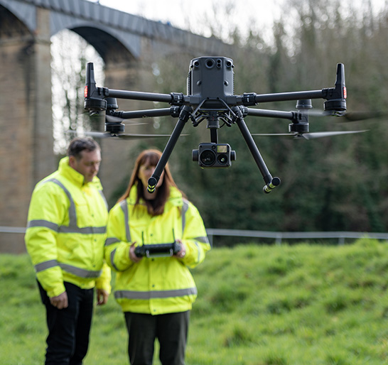
We utilise professional UAVs to deliver deliverables that are smooth to integrate with digital platforms across Dubai and the UAE. Our company allows engineers, consultants, and contractors to overcome the issue of onsite work and digital coordination. Reality capture is part of your process with us.

Sharper Data. Smarter Buildings.

The correct data results in the creation of better-constructed assets, and our mapping and survey solutions are excellent in this regard. Our drone platforms and UAVs are of high quality and produce sharp and detailed images that can be used in high-value projects. Our aerial intelligence keeps your teams on track, even when it comes to validating earthworks or updating the building information modeling models.

Aerosmart UAV Trading L.L.C. keeps assisting organisations in Dubai and the UAE to attain a higher level of planning and resource allocation with great confidence. We have our method, where all decisions made digitally are supported with onsite checked information. To ensure precise aerial data, which complements the use of BIM, we recommend surveying, mapping, and planning. Contact Aerosmart UAV Trading L.L.C. today and upgrade your drone operations throughout Dubai and the UAE.

FAQs

1. What are the benefits of drones to BIM processes?

They record site data at an accelerated rate, aiding teams to incorporate real-time imagery in the process of integrating these images into the BIM and enhancing the accuracy of surveying.

2. Are Unmanned Aerial Vehicles worthwhile in construction?

Modern UAVs provide constant and high-resolution estimates that can be used in mapping and planning in challenging projects.

3. What are the deliverables that we ought to expect?

You obtain orthomosaics, point clouds, 3D models and other digital layers that support building information modeling.

4. Are drones able to mitigate site risks?

Absolutely. A drone can be utilised to minimise survey access using a handheld survey in areas that are limited or dangerous.

5. Do you offer support in Dubai and the UAE?

Yes, our business is offering full services to customers in Dubai and the UAE. Contact us for more information.

6. Are drone surveys quicker than conventional processes?

Aerial surveying saves a lot of time, giving out faster updates to projects and planning decisions.