Aerosmart Drones | All types drones

Aerosmart UAV Trading L.L.C. is a tech company that specialises in drones and solutions in the UAE and across the GCC.

Our Office

Office 203, Al Tayer Commercial Building,
Rolla Street, Bur Dubai, UAE

Follow Us

Urban Planning Drones


Urban Planning Drone Solutions in Dubai, UAE & GCC

Urban planning is an important aspect, and we at Aerosmart support city development. Our urban planning drone solutions can help every team capture ground detail. Our prime focus here is to offer clear insight that guides you with confident decision-making.

Our company helps teams align projects with the fast growth shaping Dubai and the UAE, giving them steady information throughout every phase. These are the key benefits-

  • High grade mapping for development reviews
  • Practical site surveying for quicker documentation
  • Smarter layouts supported by accurate planning data
  • Reliable UAVs for long range inspection
  • Safe operations consistent with GCC requirements
Aerosmart Drones | All types drones

Aerial Data. Urban Vision

City planning works best with strong, clear detail. We bring aerial mapping solutions that support updates for these purposes –

  • Transport corridors
  • Land use reviews as well as
  • Zone adjustments

Our equipment captures wide site areas without disrupting ongoing work, giving planners sharper clarity across broad urban districts. We assist consultants, municipal teams and private developers with trusted UAVs built for reliable field coverage. With the continued rise of Dubai and the wider UAE, accurate surveying becomes central to design work, early assessments and district renewal. Each flight gives planners a clearer path from drawings to real-world decisions.

Here are what our client can get from us –

  • Strong visuals that support long term planning
  • Detailed mapping for documentation and oversight
  • Consistent survey inputs that reduce repeat visits
  • Safer coverage through advanced drone tools
  • A trusted GCC company supplying dependable support
Aerosmart Drones | All types drones

Smart Cities Start with Smart Mapping

Growing regions depend on solid ground insight. That is why we offer structured surveying a well as practical mapping that helps teams study land conditions. Our drone platforms give planners the right support in cities around Dubai & the UAE advance.

Our field process can improve coordination through planning phases. Teams collect the detail required for zoning alongside road reviews with UAVs. We are a committed company to have helped planners create better environments.

Drone Driven Urban Analytics for Better City Building

Here’s how we can help you-

  • Ground Truth for Better Decisions
  • Reliable Insight for Expanding Regions
  • Improved Workflow for Large Projects

FAQs

How do drones support early city planning work

Aerial tools give planners sharper ground visibility, helping them review boundaries, land shape and early site considerations. With steady mapping and accurate surveying, teams in Dubai and the UAE gain useful insight for urban decisions supported by dependable UAVs and guided by our specialist company.

Can drone data support transport layout design

Yes. Aerial visuals highlight alignment, access points and structural surroundings. Our company supplies drone systems that support survey checks, corridor studies and planning reviews linked to growing urban districts across Dubai and the UAE, helping teams refine early decisions with dependable data.

Are UAVs valuable for tracking construction progress

Our UAVs collect clear visuals that help planners monitor progress, document changes and track site conditions. Through accurate surveying, teams across Dubai and the UAE gain steady updates that improve planning and reporting for urban projects supported by our experienced company.

How accurate is drone based mapping for development work

Aerial mapping delivers the clarity needed for zoning reviews, checkups and area studies. With structured routines, each survey becomes quicker and more reliable. Our company supports urban teams with drone technologies backed by UAVs.

Do you support government and private sector planners

Yes. We work with city teams, engineering groups and consultants. With reliable UAVs, strong surveying and clear mapping, we support planning for urban districts across Dubai and the UAE, giving each company consistent field insight shaped by safe drone operations.

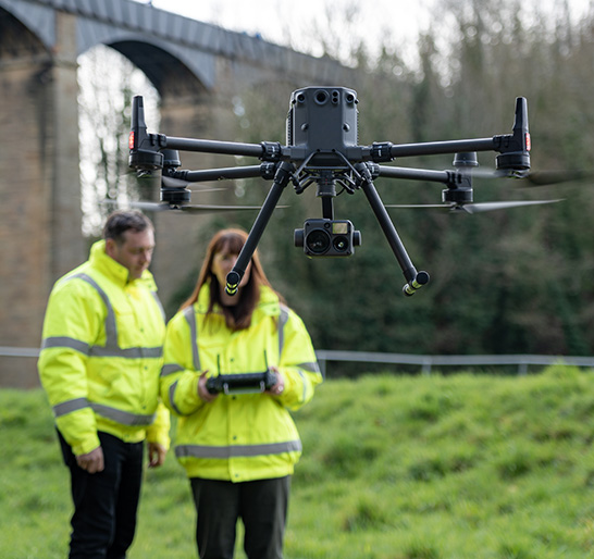
What safety approach guides your aerial work

All field activity follows aviation rules to maintain safe conditions. Our team prepares equipment, checks locations and conducts steady survey flights. Urban teams gain clear planning detail as well as strong mapping outputs that support projects across Dubai and the UAE.